MyTopo
Briscoe Ranch Texas US Topo Map
Couldn't load pickup availability
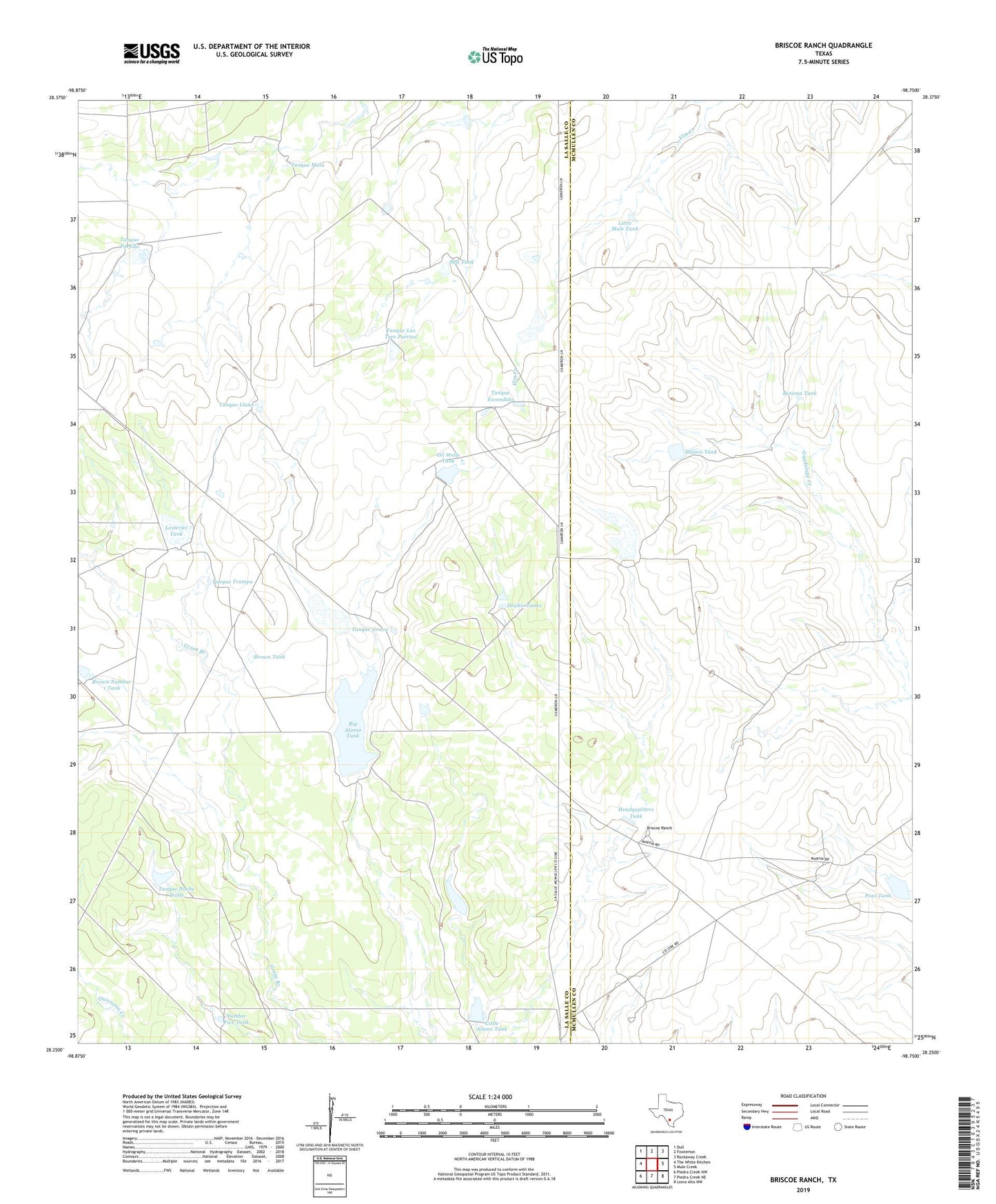
2022 topographic map quadrangle Briscoe Ranch in the state of Texas. Scale: 1:24000. Based on the newly updated USGS 7.5' US Topo map series, this map is in the following counties: La Salle, McMullen. The map contains contour data, water features, and other items you are used to seeing on USGS maps, but also has updated roads and other features. This is the next generation of topographic maps. Printed on high-quality waterproof paper with UV fade-resistant inks.
Quads adjacent to this one:
West: The White Kitchen
Northwest: Dull
North: Fowlerton
Northeast: Rockaway Creek
East: Mule Creek
Southeast: Loma Alta NW
South: Piedra Creek NE
Southwest: Piedra Creek NW
This map covers the same area as the classic USGS quad with code o28098c7.
Contains the following named places: Alexander Lake Number 1 Dam, Alexander Lake Number 2, Alexander Lake Number 2 Dam, Alexander Lake Number 3 Dam, Big Alamo Lake Dam, Big Alamo Tank, Blanco Tank, Blanco Tank Dam, Bounds Lake, Bounds Lake Dam, Briscoe Ranch, Brown Lake, Brown Lake Dam, Brown Number 1 Tank, Brown Tank, Double Tanks, Guadalupe Tank, Guadalupe Tank Dam, Headquarters Tank, Headquarters Tank Dam, Lesterjet Tank, Little Alamo Lake Dam, Little Alamo Tank, Little Mule Tank, Number Five Tank, Oil Wells Tank, Pozo Tank, Pozo Tank Dam, Retama Tank, Retama Tank Dam, Salt Tank, Tanque Escondido, Tanque Grava, Tanque Las Tres Puertas, Tanque Llano, Tanque Mula, Tanque Noche Triste, Tanque Noche Triste Tank Dam, Tanque Porfido, Tanque Trampa