MyTopo
Platt Texas US Topo Map
Couldn't load pickup availability
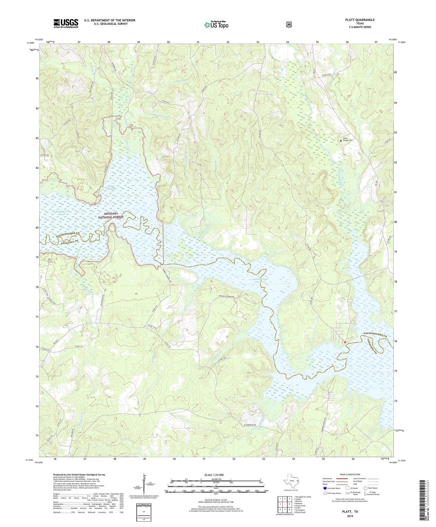
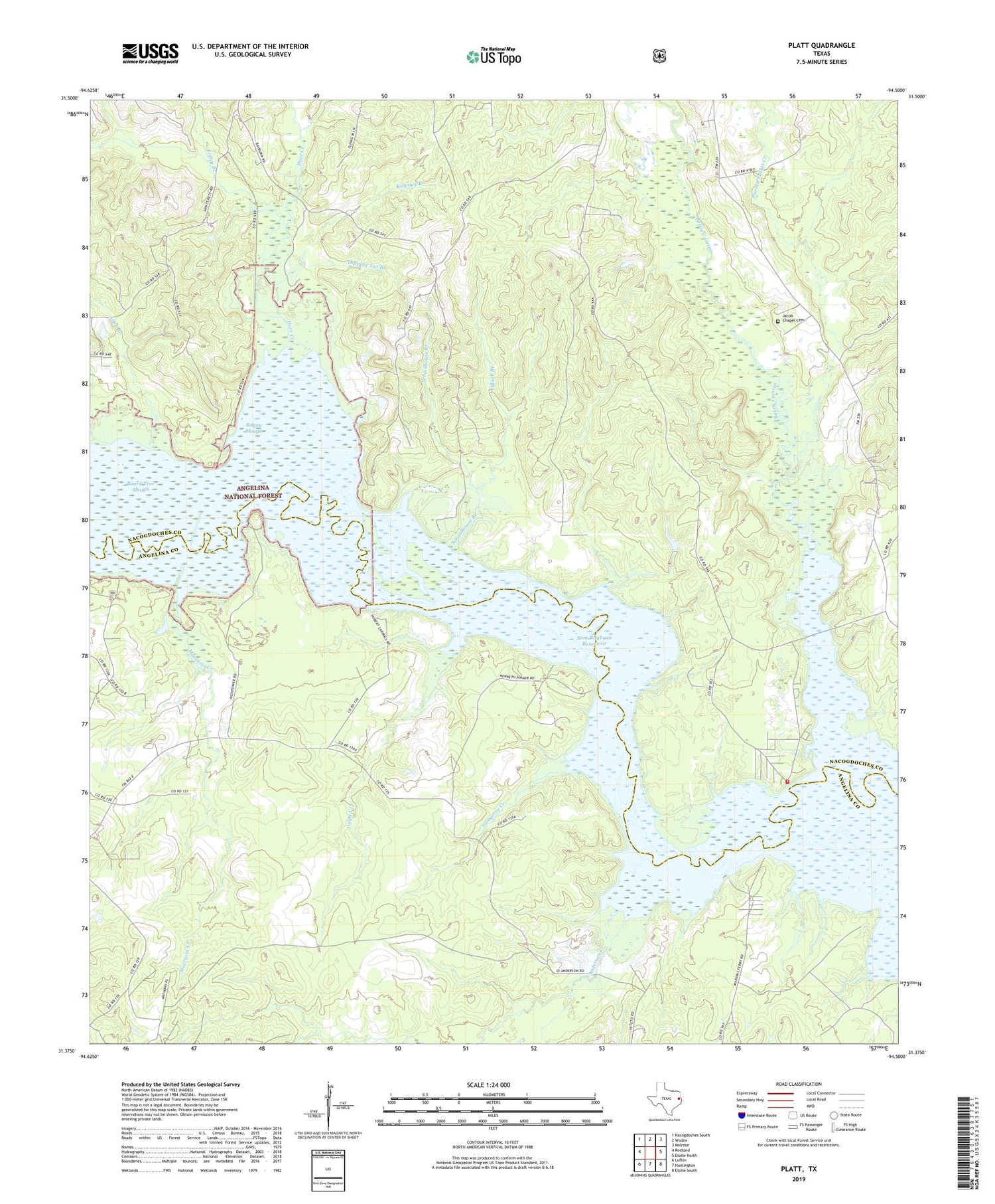
2019 topographic map quadrangle Platt in the state of Texas. Scale: 1:24000. Based on the newly updated USGS 7.5' US Topo map series, this map is in the following counties: Nacogdoches, Angelina. The map contains contour data, water features, and other items you are used to seeing on USGS maps, but also has updated roads and other features. This is the next generation of topographic maps. Printed on high-quality waterproof paper with UV fade-resistant inks.
Quads adjacent to this one:
West: Redland
Northwest: Nacogdoches South
North: Woden
Northeast: Melrose
East: Etoile North
Southeast: Etoile South
South: Huntington
Southwest: Lufkin
Contains the following named places: Allen Branch, Anderson Creek, Bayou Carrizo, Black Branch, Board Tree Slough, Boggy Slough, Dipping Vat Branch, Dorr Creek, Dorty Creek, Ester Lake, Finley Branch, Hill Lake, Jacob Chapel Cemetery, Kimmey Branch, Kingtown Volunteer Fire Department, Marion, Marion Ferry Park, Marion Ferry Recreation Site, Moccasin Creek, Platt, Poe, Puenta Suelas Creek, Saints Rest Church, Schoolhouse Branch, Swagerty Creek, Victory Church