MyTopo
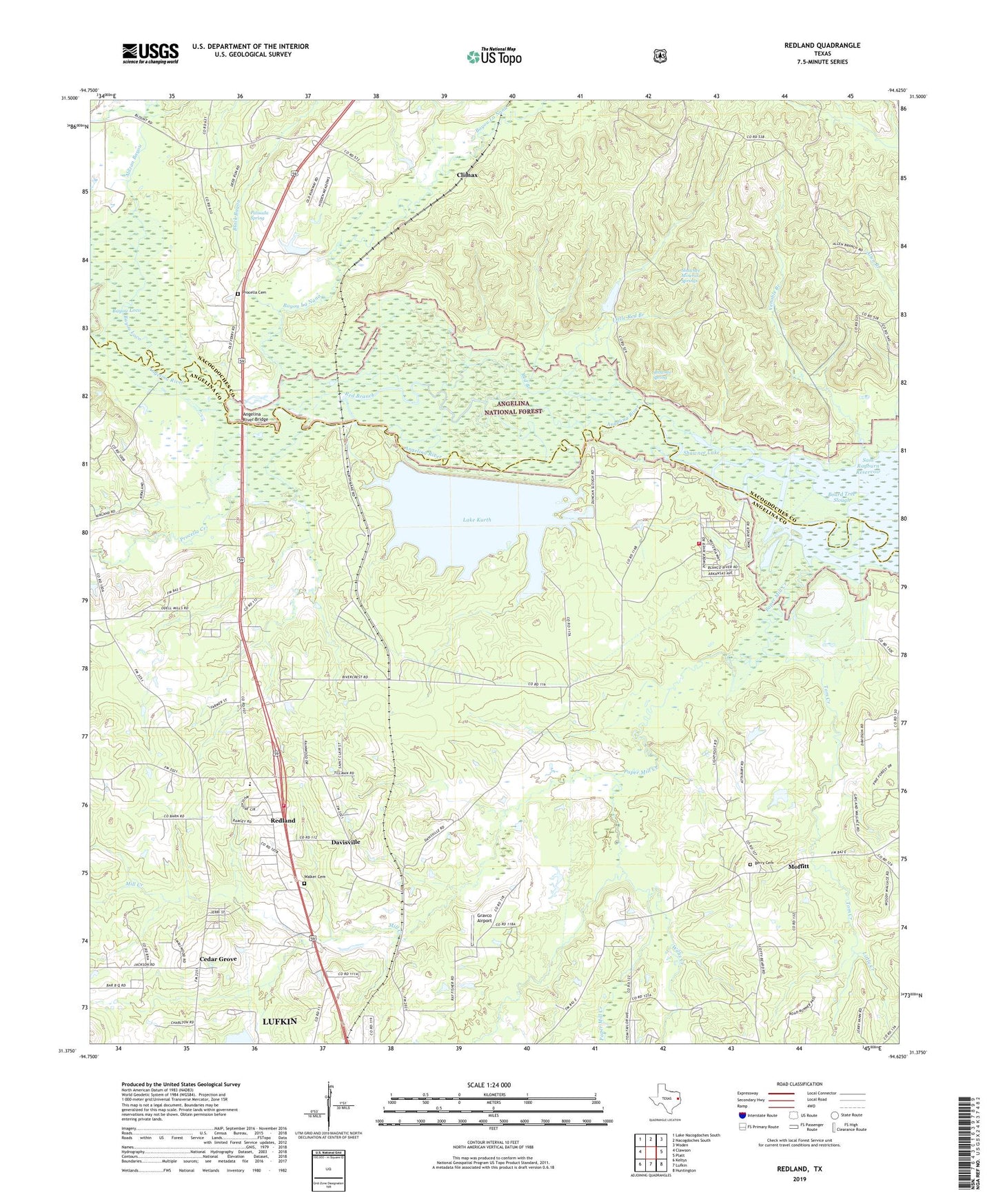
Redland Texas US Topo Map
Couldn't load pickup availability
Also explore the Redland Forest Service Topo of this same quad for updated USFS data
2022 topographic map quadrangle Redland in the state of Texas. Scale: 1:24000. Based on the newly updated USGS 7.5' US Topo map series, this map is in the following counties: Angelina, Nacogdoches. The map contains contour data, water features, and other items you are used to seeing on USGS maps, but also has updated roads and other features. This is the next generation of topographic maps. Printed on high-quality waterproof paper with UV fade-resistant inks.
Quads adjacent to this one:
West: Clawson
Northwest: Lake Nacogdoches South
North: Nacogdoches South
Northeast: Woden
East: Platt
Southeast: Huntington
South: Lufkin
Southwest: Keltys
This map covers the same area as the classic USGS quad with code o31094d6.
Contains the following named places: Angelina River Bridge, Bayou La Nana, Bayou oa Nana, Berry Cemetery, Black Bayou, Cedar Grove, Climax, Davisville, Davisville Church, Davisville Station, Ellen Trout Memorial Lake Dam, Gravco Airport, Hog Pen Lake, Just Plane Fun Airpark, Kurth Dam, Lake Kurth, Little Creek, Little Red Branch, Lower Island, Lufkin Water Plant, Mill Creek, Moffitt, Morral Bayou, Palisada Spring, Paper Mill Creek, Procella Cemetery, Procella Creek, Red Branch, Redland, Redland Census Designated Place, River Crest Estates, Rivercrest Redland Volunteer Fire Department Station 1, Rivercrest Redland Volunteer Fire Department Station 2, Saint Anns School, Shawnee Lake, Shawnee Mineral Springs, Shawnee Spring, Tom Creek, Venable Branch, Walker Cemetery, Willis Creek