MyTopo
Etoile South Texas US Topo Map
Couldn't load pickup availability
Also explore the Etoile South Forest Service Topo of this same quad for updated USFS data
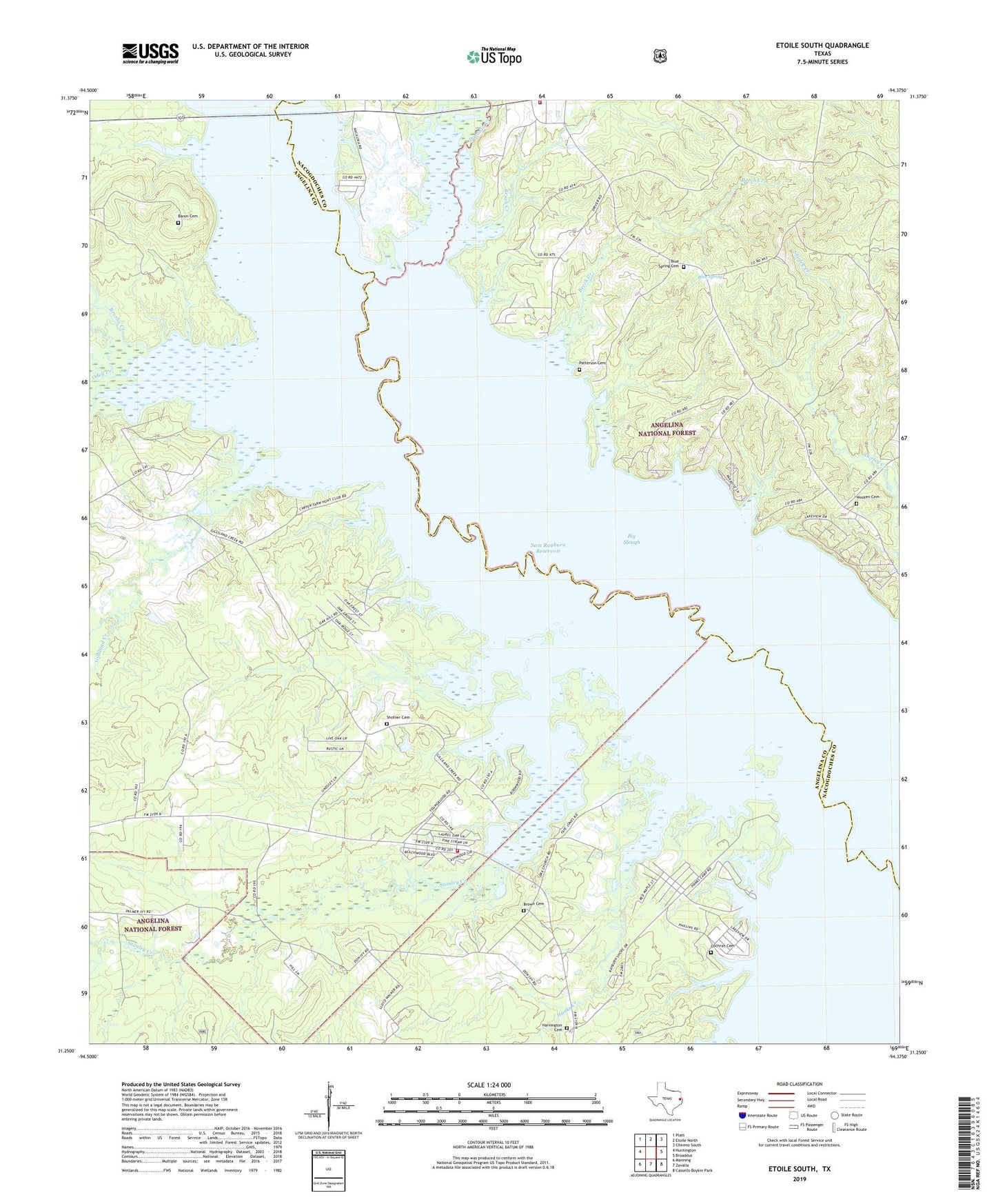
2022 topographic map quadrangle Etoile South in the state of Texas. Scale: 1:24000. Based on the newly updated USGS 7.5' US Topo map series, this map is in the following counties: Angelina, Nacogdoches. The map contains contour data, water features, and other items you are used to seeing on USGS maps, but also has updated roads and other features. This is the next generation of topographic maps. Printed on high-quality waterproof paper with UV fade-resistant inks.
Quads adjacent to this one:
West: Huntington
Northwest: Platt
North: Etoile North
Northeast: Chireno South
East: Broaddus
Southeast: Cassells-Boykin Park
South: Zavalla
Southwest: Manning
This map covers the same area as the classic USGS quad with code o31094c4.
Contains the following named places: Baron Cemetery, Beech Creek, Big Slough, Blue Spring, Blue Spring Cemetery, Brown Cemetery, Brush Creek, Brushy Creek, Cochran Cemetery, Duranzo Creek, Etoile Lookout, Etoile Post Office, Etoile Volunteer Fire Department, Ewing, Gilliland Creek, Hanks Creek, Hanks Creek Park Campground, Harnington Cemetery, Nacalina, Odell Creek, Ora, Ora Volunteer Fire Department, Patterson Cemetery, Shirley Creek, Shofner Cemetery, Stanley Creek, Wooten Cemetery, ZIP Code: 75944