MyTopo
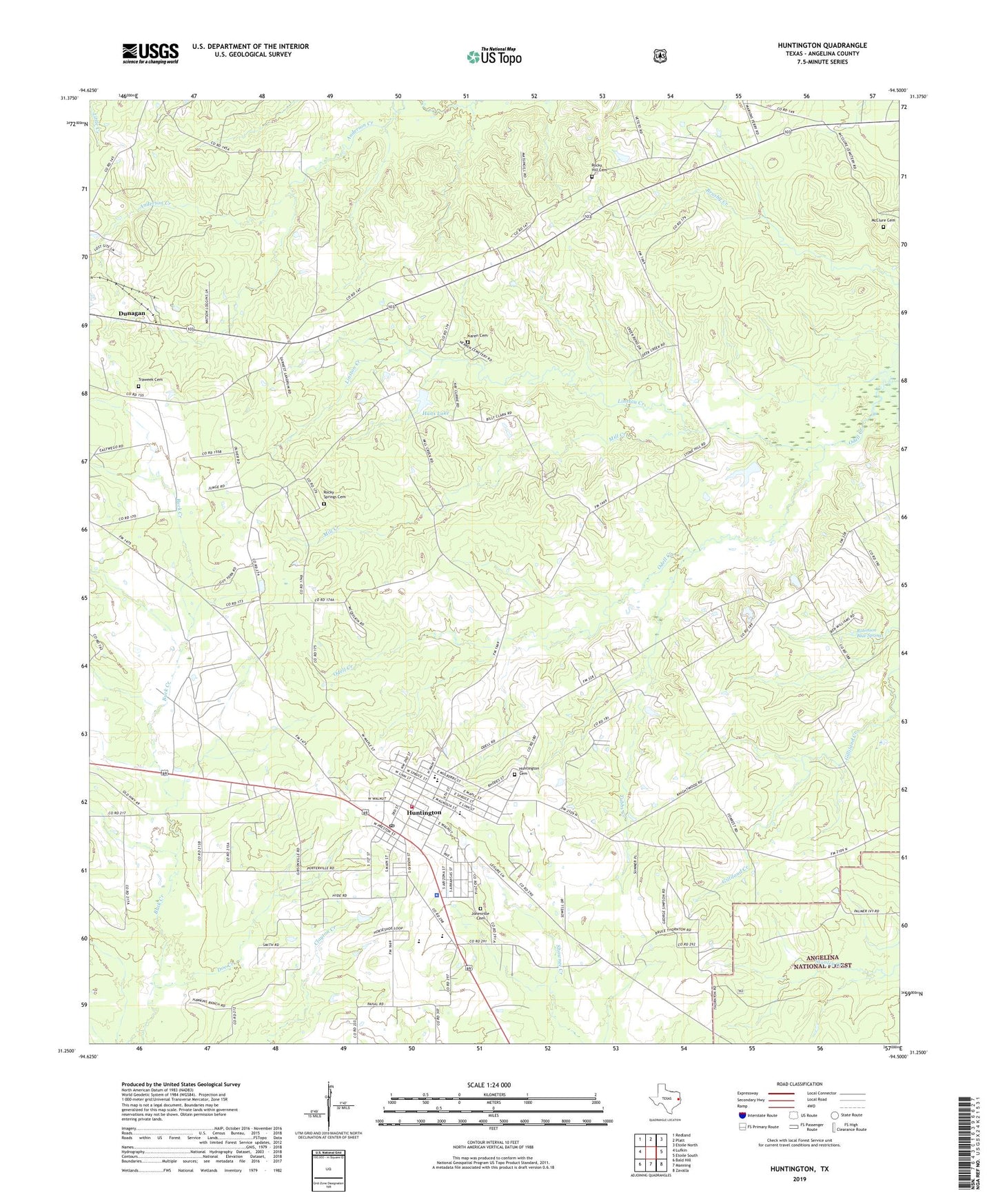
Huntington Texas US Topo Map
Couldn't load pickup availability
Also explore the Huntington Forest Service Topo of this same quad for updated USFS data
2022 topographic map quadrangle Huntington in the state of Texas. Scale: 1:24000. Based on the newly updated USGS 7.5' US Topo map series, this map is in the following counties: Angelina. The map contains contour data, water features, and other items you are used to seeing on USGS maps, but also has updated roads and other features. This is the next generation of topographic maps. Printed on high-quality waterproof paper with UV fade-resistant inks.
Quads adjacent to this one:
West: Lufkin
Northwest: Redland
North: Platt
Northeast: Etoile North
East: Etoile South
Southeast: Zavalla
South: Manning
Southwest: Bald Hill
This map covers the same area as the classic USGS quad with code o31094c5.
Contains the following named places: Alco, Angelina County, Angelina County Constable's Office Precinct 3, Castleberry Dam, Castleberry Lake, City of Huntington, Doe Creek, Dunagan, Dunham Hill, Hans Lake, Hans Lake Dam, Huntington, Huntington Cemetery, Huntington City Hall, Huntington Intermediate School, Huntington Police Department, Huntington Post Office, Huntington Volunteer Fire Department, Jonesville Cemetery, Linston Creek, Little Flock Church, Little Hope Church, McClure Cemetery, Mill Creek, Naren Cemetery, Oak Flat, Odell Church, Robinson Blue Springs, Rocky Hill Cemetery, Rocky Hill School, Rocky Springs, Rocky Springs Cemetery, Thomas Crossing, Traweek Cemetery, Tubbs Creek