MyTopo
Plum Grove Texas US Topo Map
Couldn't load pickup availability
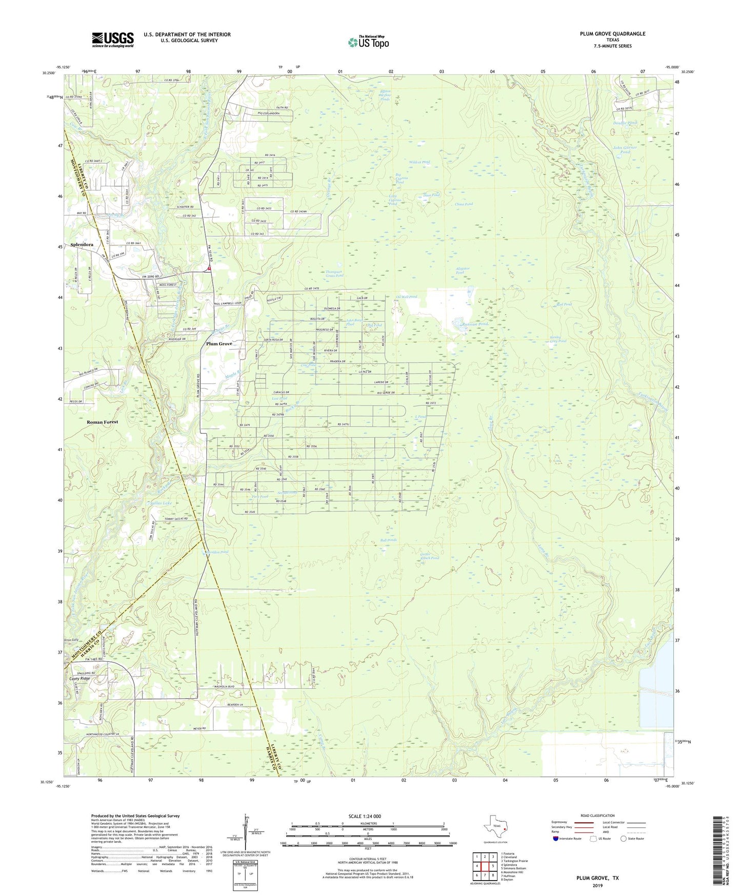
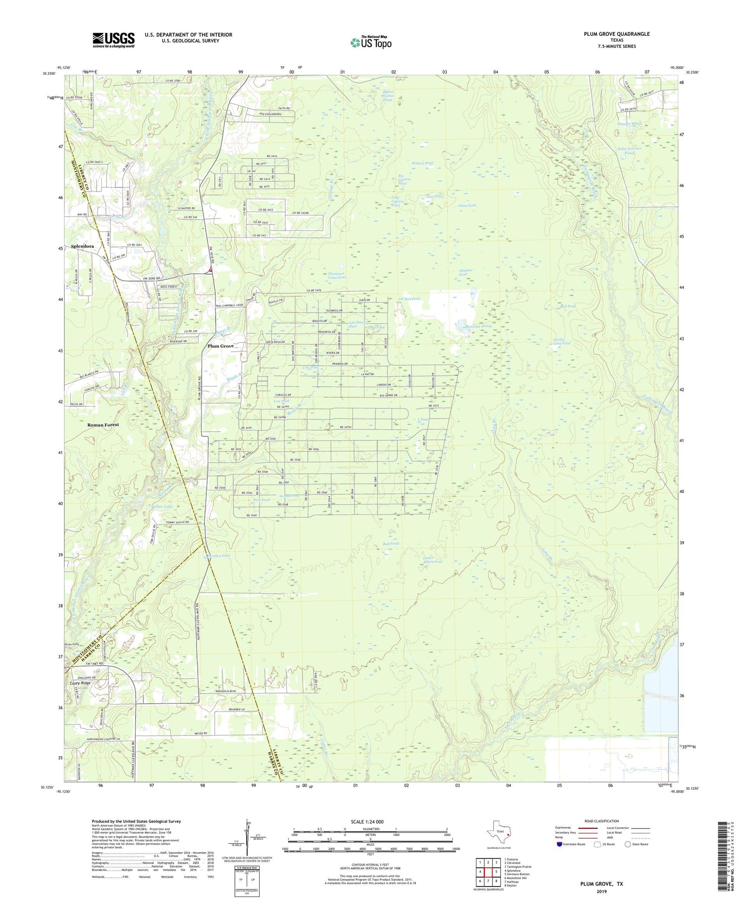
2019 topographic map quadrangle Plum Grove in the state of Texas. Scale: 1:24000. Based on the newly updated USGS 7.5' US Topo map series, this map is in the following counties: Liberty, Montgomery, Harris. The map contains contour data, water features, and other items you are used to seeing on USGS maps, but also has updated roads and other features. This is the next generation of topographic maps. Printed on high-quality waterproof paper with UV fade-resistant inks.
Quads adjacent to this one:
West: Splendora
Northwest: Fostoria
North: Cleveland
Northeast: Tarkington Prairie
East: Simmons Bottom
Southeast: Dayton
South: Huffman
Southwest: Moonshine Hill
Contains the following named places: Alligator Pond, Big Cypress Pond, Big Pond, Bird Pond, Bull Ponds, Button Willow Ponds, Carter Ranch Pond, Casey Ridge, China Pond, City of Plum Grove, Cordy Branch, Cow Branch, Cow Pond, Dina Pond, Double Pond, East River Lookout, First Pond, Herndon Pond, High Top Camp, John Baret Pond, John Garner Pond, KJZS-FM (Conroe), KSBJ-FM (Humble), L Pond, Lick Branch, Little Cypress Pond, Long Branch, Lost Pond, Maple Branch, Oil Well Pond, Orange Branch, Orton Gully, Pin Oak Reservoir, Pin Oak Reservoir Levee, Plum Grove, Plum Grove Cemetery, Plum Grove Volunteer Fire Department, Rocky Branch, Russian Pond, Sallas Lake, Second Pond, Simms Gulley, Thompson Grass Pond, Wesley Grey Pond, Wildcat Pond