MyTopo
Simmons Bottom Texas US Topo Map
Couldn't load pickup availability
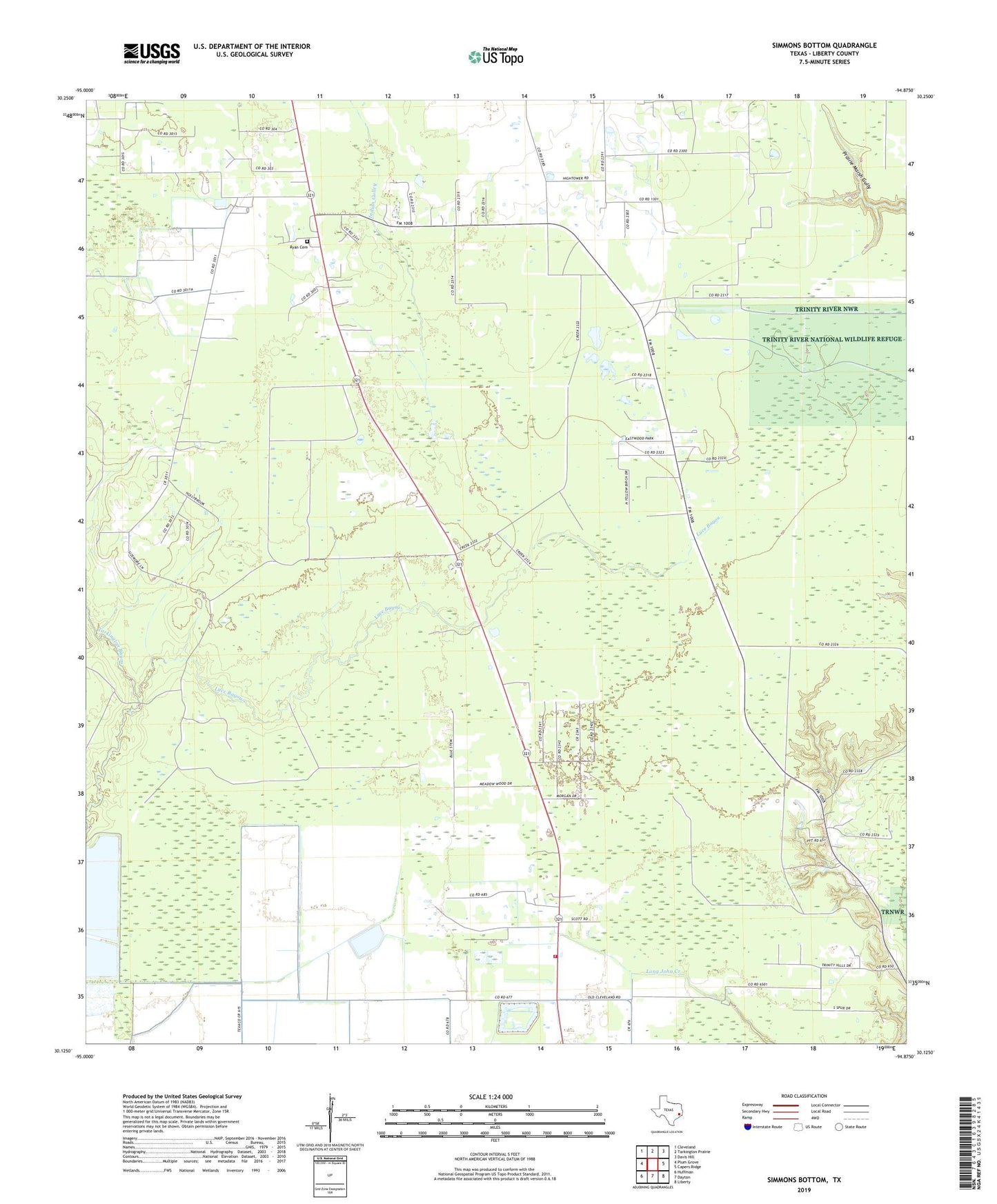
2022 topographic map quadrangle Simmons Bottom in the state of Texas. Scale: 1:24000. Based on the newly updated USGS 7.5' US Topo map series, this map is in the following counties: Liberty. The map contains contour data, water features, and other items you are used to seeing on USGS maps, but also has updated roads and other features. This is the next generation of topographic maps. Printed on high-quality waterproof paper with UV fade-resistant inks.
Quads adjacent to this one:
West: Plum Grove
Northwest: Cleveland
North: Tarkington Prairie
Northeast: Davis Hill
East: Capers Ridge
Southeast: Liberty
South: Dayton
Southwest: Huffman
This map covers the same area as the classic USGS quad with code o30094b8.
Contains the following named places: Carter Settlement, Highway 321 Volunteer Fire Department, Indian Gulley, Ryan Cemetery, Simmons Bottom, Tarkington Bayou, Winter Valley Estates