MyTopo
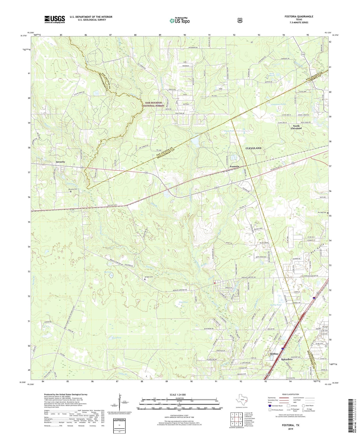
Fostoria Texas US Topo Map
Couldn't load pickup availability
Also explore the Fostoria Forest Service Topo of this same quad for updated USFS data
2022 topographic map quadrangle Fostoria in the state of Texas. Scale: 1:24000. Based on the newly updated USGS 7.5' US Topo map series, this map is in the following counties: Montgomery, San Jacinto, Liberty. The map contains contour data, water features, and other items you are used to seeing on USGS maps, but also has updated roads and other features. This is the next generation of topographic maps. Printed on high-quality waterproof paper with UV fade-resistant inks.
Quads adjacent to this one:
West: Cut And Shoot
Northwest: Conroe NE
North: Bear Creek
Northeast: Westcott
East: Cleveland
Southeast: Plum Grove
South: Splendora
Southwest: Outlaw Pond
This map covers the same area as the classic USGS quad with code o30095c2.
Contains the following named places: Bailey Pond, Bee Branch, Big Pond, Cain Branch, Calvary Church, Chapman Ponds, Crossroads Church, Duck Creek, East River, Fostoria, Friendship Church, Grassy Pond, Gum Branch, Hightower Branch, Horse Marsh, Jayhawker Creek, KJZS-FM (Conroe), KTFH-TV (Conroe), Lawrence Creek, Midline, Morgan Cemetery, North Cleveland, Pilgrim Rest Church, Pin Oak Cemetery, Red Branch, Round Pond, Security, Security Calvery Baptist Church, Security Cemetery, Security First Baptist Church, Security Siding, Shady Run, Shell Branch, Splendora Fire Department Station 162, Splendora Stadium, TGP 25 Heliport, United Baptist Church, Ward Pond