MyTopo
Huffman Texas US Topo Map
Couldn't load pickup availability
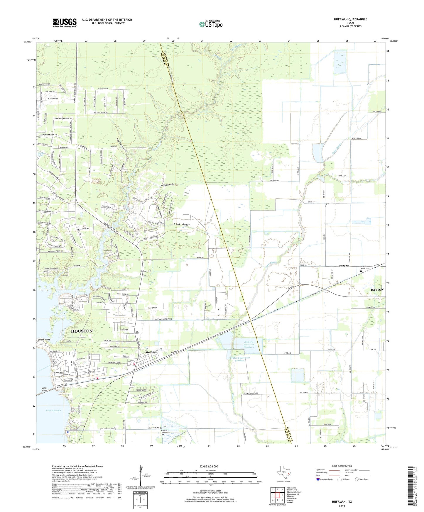
2022 topographic map quadrangle Huffman in the state of Texas. Scale: 1:24000. Based on the newly updated USGS 7.5' US Topo map series, this map is in the following counties: Harris, Liberty. The map contains contour data, water features, and other items you are used to seeing on USGS maps, but also has updated roads and other features. This is the next generation of topographic maps. Printed on high-quality waterproof paper with UV fade-resistant inks.
Quads adjacent to this one:
West: Moonshine Hill
Northwest: Splendora
North: Plum Grove
Northeast: Simmons Bottom
East: Dayton
Southeast: Sheeks
South: Crosby
Southwest: Harmaston
This map covers the same area as the classic USGS quad with code o30095a1.
Contains the following named places: Ben Bowen Elementary School, Bowen Elementary School, Calvary Baptist Chapel Church, Camp Branch, Church on the Lake, Copeland Intermediate School, Copeland School, Eastgate, Eastgate Church, Glad Tidings Pentecostal Church of God, Hargrave High School, Hidden Echo, Houston Fire Department Station 65, Houston Fire Station Number 65, Houston Police Department - Lake Houston, Huffman, Huffman Cemetery, Huffman Church, Huffman Community Cemetery, Huffman Middle School, Huffman Oaks, Huffman Post Office, Huffman School, Huffman Volunteer Fire Department Station 1, John Young Gully, Key Gully, L T May Park, Lake Houston United Methodist Church, Lakeside Manor, Lakewood Heights, Luce, Luce Bayou, May Community Center, Mexican Gully, Red Gully, Saint Annes Cemetery, Saint Annes Church, Saint Philip the Apostle Catholic Church, Scotts Point, Seaberg Reservoir Number 1, Seaberg Reservoir Number 1 Levee, Seaberg Reservoir Number 2, Seaberg Reservoir Number 2 Levee, Seaberg Reservoir Number 3, Seaberg Reservoir Number 3 Dam, Seaberg Reservoir Number 4, Seaberg Reservoir Number 4 Dam, Shook Gully, Shorewood, Vine Life Fellowship Church, ZIP Code: 77336