MyTopo
Poth Texas US Topo Map
Couldn't load pickup availability
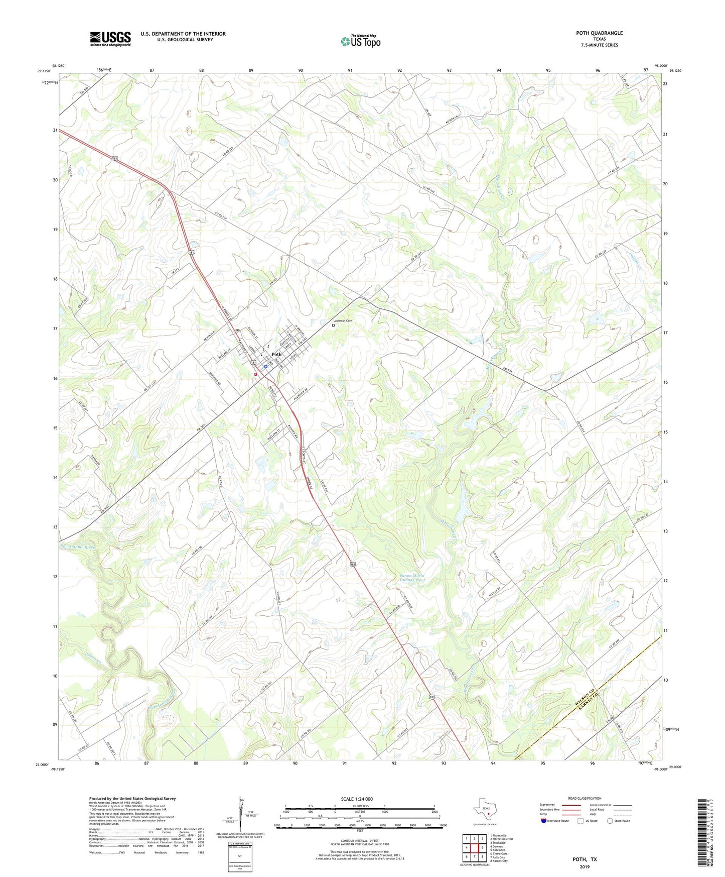
2019 topographic map quadrangle Poth in the state of Texas. Scale: 1:24000. Based on the newly updated USGS 7.5' US Topo map series, this map is in the following counties: Wilson, Karnes. The map contains contour data, water features, and other items you are used to seeing on USGS maps, but also has updated roads and other features. This is the next generation of topographic maps. Printed on high-quality waterproof paper with UV fade-resistant inks.
Quads adjacent to this one:
West: Dewees
Northwest: Floresville
North: Marcelinas Hills
Northeast: Stockdale
East: Kosciusko
Southeast: Karnes City
South: Falls City
Southwest: Three Oaks
Contains the following named places: Bienek Oil Field, Blessed Sacrament Church, Falls City Oil Field, Kotzur Lake, Kotzur Lake Dam, Lutheran Cemetery, Olmos Creek, Panna Maria Tailings Pond, Panna Maria Tailings Pond Dam, Poth, Poth City Hall, Poth Division, Poth Elementary School, Poth Junior High School, Poth Police Department, Poth Post Office, Poth Volunteer Fire Department, Town of Poth, ZIP Code: 78147