MyTopo
Falls City Texas US Topo Map
Couldn't load pickup availability
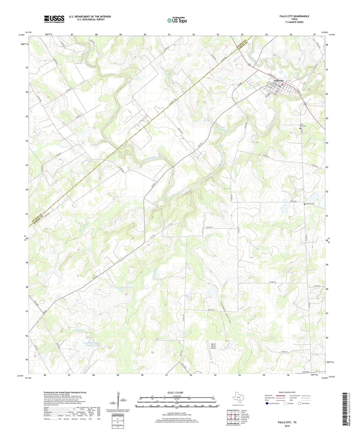
2022 topographic map quadrangle Falls City in the state of Texas. Scale: 1:24000. Based on the newly updated USGS 7.5' US Topo map series, this map is in the following counties: Karnes, Wilson. The map contains contour data, water features, and other items you are used to seeing on USGS maps, but also has updated roads and other features. This is the next generation of topographic maps. Printed on high-quality waterproof paper with UV fade-resistant inks.
Quads adjacent to this one:
West: Three Oaks
Northwest: Dewees
North: Poth
Northeast: Kosciusko
East: Karnes City
Southeast: Lenz
South: Coy City
Southwest: Fashing
This map covers the same area as the classic USGS quad with code o28098h1.
Contains the following named places: Burris Ranch Airport, City of Falls City, Conquista Creek, Conquista Crossing, Conquista Project Tailings Pond, Conquista Project Tailings Pond Dam, Deweesville, Falls City, Falls City Cemetery, Falls City Division, Falls City Elementary School, Falls City Hall, Falls City High School, Falls City Post Office, Falls City Volunteer Fire Department, Hobson Oil Field, Hysaw Oil Field, Las Moras Creek, Marcelinas Creek, Mays Crossing, Mueller Cemetery, Nieschwietz Lake, Nieschwietz Lake Dam, Picket Hollow, Scared Dog Creek, Skiles Falls