MyTopo
Dewees Texas US Topo Map
Couldn't load pickup availability
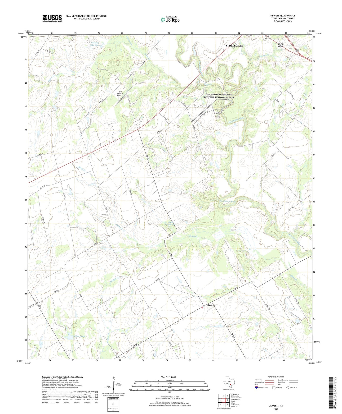
2022 topographic map quadrangle Dewees in the state of Texas. Scale: 1:24000. Based on the newly updated USGS 7.5' US Topo map series, this map is in the following counties: Wilson. The map contains contour data, water features, and other items you are used to seeing on USGS maps, but also has updated roads and other features. This is the next generation of topographic maps. Printed on high-quality waterproof paper with UV fade-resistant inks.
Quads adjacent to this one:
West: Saspamco SE
Northwest: Saspamco
North: Floresville
Northeast: Marcelinas Hills
East: Poth
Southeast: Falls City
South: Three Oaks
Southwest: Leal
This map covers the same area as the classic USGS quad with code o29098a2.
Contains the following named places: Camp Ranch, Circle P Ranch Airport, Connally Lake Dam 2, Connally Lake Dam Number 1, Connally Ranch, Darilek, Dewees, Dewees Ranch, Kilgore Lake, Kilgore Lake Dam, Loma Vista, Mariana Creek, Mission of Las Cabreras, Pajarito Creek, Picosa Creek, Ridout, Sacred Heart Cemetery, Seale Ranch Lake, Seale Ranch Lake Dam, Three Oaks Volunteer Fire Department, Wall Flying Service Airport, ZIP Code: 78114