MyTopo
Potosi Texas US Topo Map
Couldn't load pickup availability
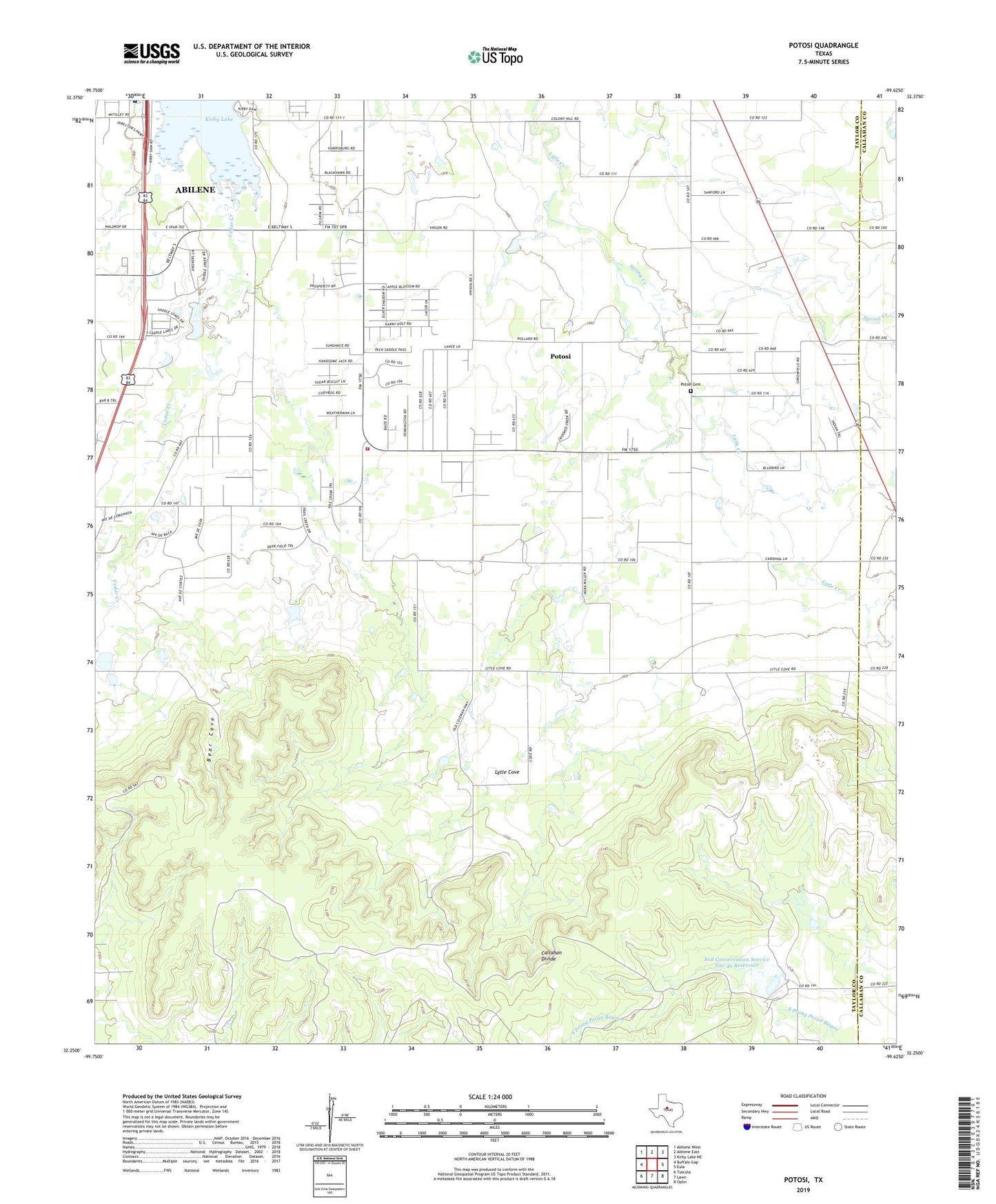
2019 topographic map quadrangle Potosi in the state of Texas. Scale: 1:24000. Based on the newly updated USGS 7.5' US Topo map series, this map is in the following counties: Taylor, Callahan. The map contains contour data, water features, and other items you are used to seeing on USGS maps, but also has updated roads and other features. This is the next generation of topographic maps. Printed on high-quality waterproof paper with UV fade-resistant inks.
Quads adjacent to this one:
West: Buffalo Gap
Northwest: Abilene West
North: Abilene East
Northeast: Kirby Lake NE
East: Eula
Southeast: Oplin
South: Lawn
Southwest: Tuscola
Contains the following named places: Abilene Regional Medical Center Heliport, Bear Cove, Black Lease Quarry, Hendrick Medical Center South, KAGN-FM (Abilene), KEYJ-FM (Abilene), KGNZ-FM (Abilene), Kirby Lake, KRBC-TV (Abilene), Lytle Cove, Potosi, Potosi Cemetery, Potosi Census Designated Place, Potosi School, Potosi United Methodist Church, Potosi Volunteer Fire Department, Soil Conservation Service Site 4a Dam, Soil Conservation Service Site 4a Reservoir, Soil Conservation Service Site 5 Dam, Soil Conservation Service Site 5 Reservoir, Spring Creek, Thompson - Sawyer Public Library, Trinity Chapel Pentecostal Church of God, ZIP Code: 79602