MyTopo
Primrose Texas US Topo Map
Couldn't load pickup availability
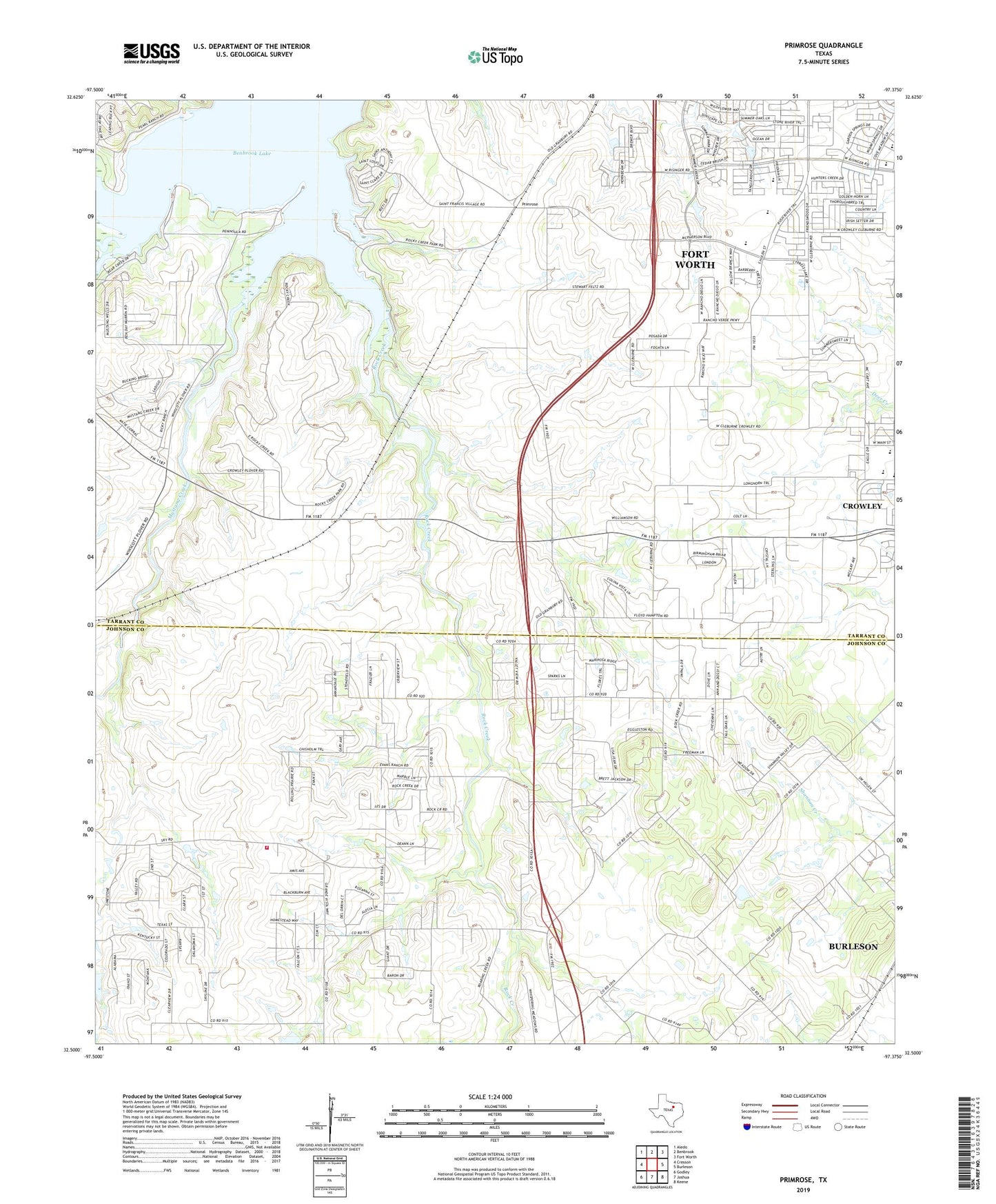
2019 topographic map quadrangle Primrose in the state of Texas. Scale: 1:24000. Based on the newly updated USGS 7.5' US Topo map series, this map is in the following counties: Tarrant, Johnson. The map contains contour data, water features, and other items you are used to seeing on USGS maps, but also has updated roads and other features. This is the next generation of topographic maps. Printed on high-quality waterproof paper with UV fade-resistant inks.
Quads adjacent to this one:
West: Cresson
Northwest: Aledo
North: Benbrook
Northeast: Fort Worth
East: Burleson
Southeast: Keene
South: Joshua
Southwest: Godley
Contains the following named places: Bear Creek, CareFlite - Johnson County Station 2, Crowley Church of Christ, Crowley Middle School, Eagle Stadium, First Baptist Church of Crowley, Godley Fire Department Station 2, Mustang Creek, Mustang Park, North Crowley High School, Panther Stadium, Plover, Plover Heliport, Primrose, Rock Creek, Rocky Creek Park, Saint Francis Village, Saint Francis Village Water Treatment Facility, ZIP Codes: 76036, 76123