MyTopo
Aledo Texas US Topo Map
Couldn't load pickup availability
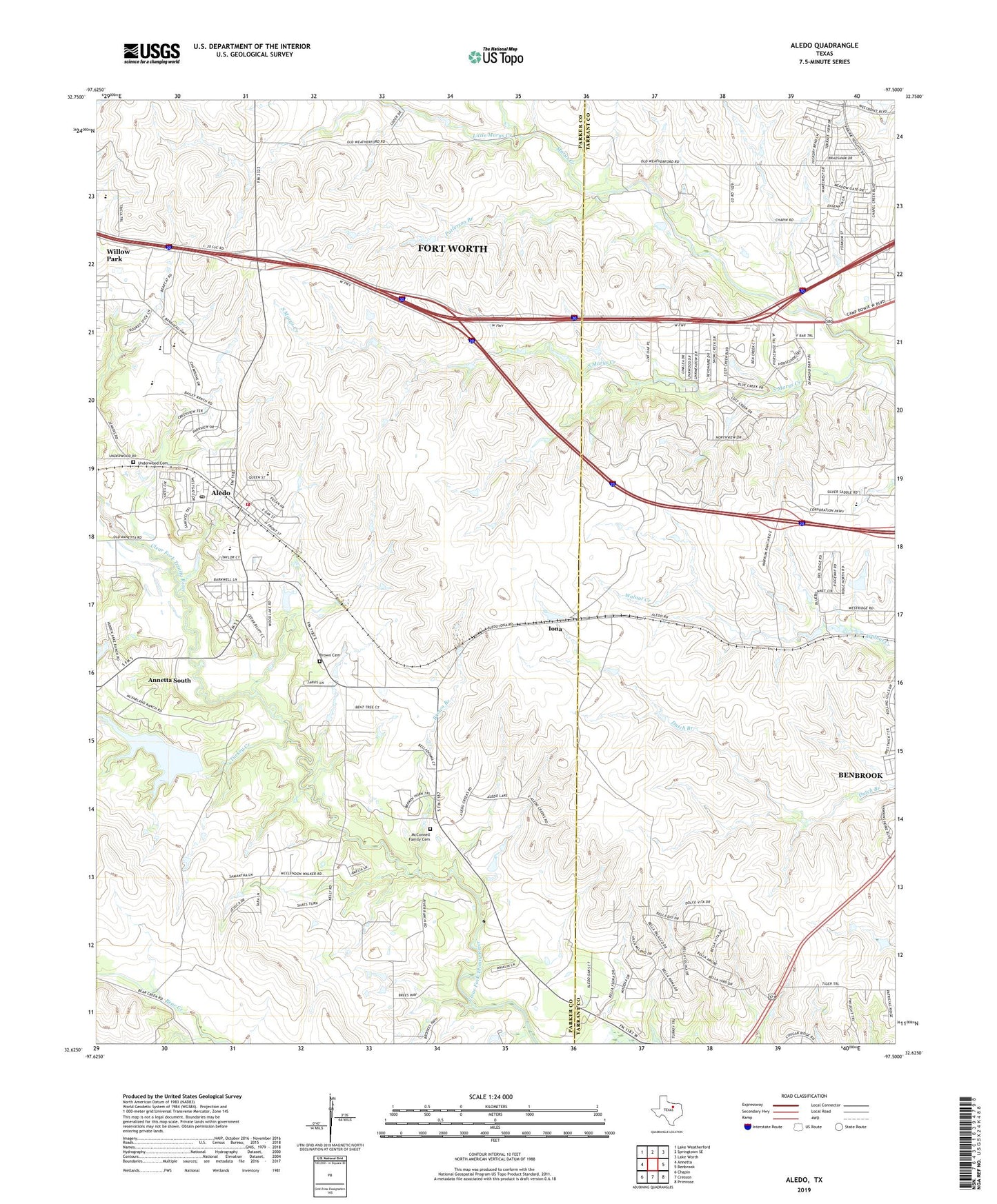
2022 topographic map quadrangle Aledo in the state of Texas. Scale: 1:24000. Based on the newly updated USGS 7.5' US Topo map series, this map is in the following counties: Parker, Tarrant. The map contains contour data, water features, and other items you are used to seeing on USGS maps, but also has updated roads and other features. This is the next generation of topographic maps. Printed on high-quality waterproof paper with UV fade-resistant inks.
Quads adjacent to this one:
West: Annetta
Northwest: Lake Weatherford
North: Springtown SE
Northeast: Lake Worth
East: Benbrook
Southeast: Primrose
South: Cresson
Southwest: Chapin
This map covers the same area as the classic USGS quad with code o32097f5.
Contains the following named places: Aledo, Aledo - Brown Cemetery, Aledo City Hall, Aledo Elementary School, Aledo High School Baseball Field, Aledo Post Office, Aledo United Methodist Church, Aledo Volunteer Fire Department Station 1, Bearcat Stadium, Brown Branch, Bucker Field, City of Aledo, Cole - Markham Cemetery, Faith Baptist Mission Church, Iona, Lake Montex, Lake Montex Dam, Little Marys Creek, Markum Ranch Airport, McConnell Family Cemetery, Patterson Branch, Petitfils Lake, Petitfils Lake Dam, Resurrection Lutheran Church, South Marys Creek, Triple S Airport, Turkey Creek, Underwood Cemetery, ZIP Code: 76126