MyTopo
Quinlan Texas US Topo Map
Couldn't load pickup availability
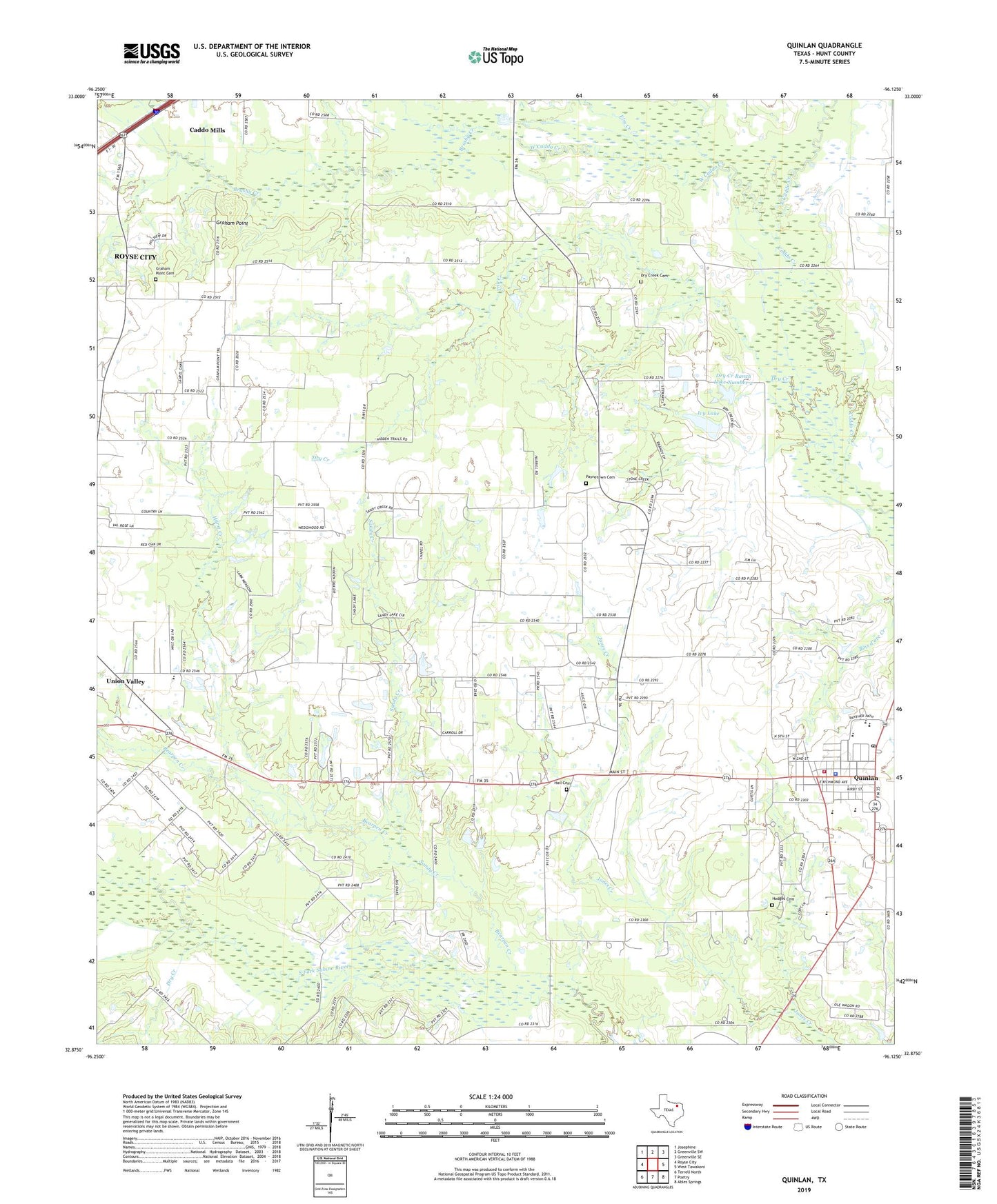
2019 topographic map quadrangle Quinlan in the state of Texas. Scale: 1:24000. Based on the newly updated USGS 7.5' US Topo map series, this map is in the following counties: Hunt. The map contains contour data, water features, and other items you are used to seeing on USGS maps, but also has updated roads and other features. This is the next generation of topographic maps. Printed on high-quality waterproof paper with UV fade-resistant inks.
Quads adjacent to this one:
West: Royse City
Northwest: Josephine
North: Greenville SW
Northeast: Greenville SE
East: West Tawakoni
Southeast: Ables Springs
South: Poetry
Southwest: Terrell North
Contains the following named places: A E Butler Intermediate School, Bearpen Creek, Brushy Creek, C B Thompson Middle School, City of Caddo Mills, City of Quinlan, City of Union Valley, Dry Creek, Dry Creek Cemetery, Dry Creek Ranch Lake Number 1, Dry Creek Ranch Lake Number 1 Dam, Dry Creek Ranch Lake Number 2, Dry Creek Ranch Lake Number 2 Dam, East Caddo Creek, Elm Creek, Flying 'T' Ranch Airport, Ford High School, Graham Point, Graham Point Cemetery, Hail Cemetery, Hodges Cemetery, Hunt County Constable's Office Precinct 4, Hurst Creek, Ivy Lake, Ivy Lake Dam, Joe Martin Early Childhood Center, Lytal Stadium, Paynetown Cemetery, Quinlan, Quinlan City Hall, Quinlan Division, Quinlan Police Department, Quinlan Post Office, Quinlan Public School, Quinlan Volunteer Fire Department, Sandy Creek, Stringtown Community Center, Tawakoni Area Public Library, West Caddo Creek, Williams Chapel