MyTopo
West Tawakoni Texas US Topo Map
Couldn't load pickup availability
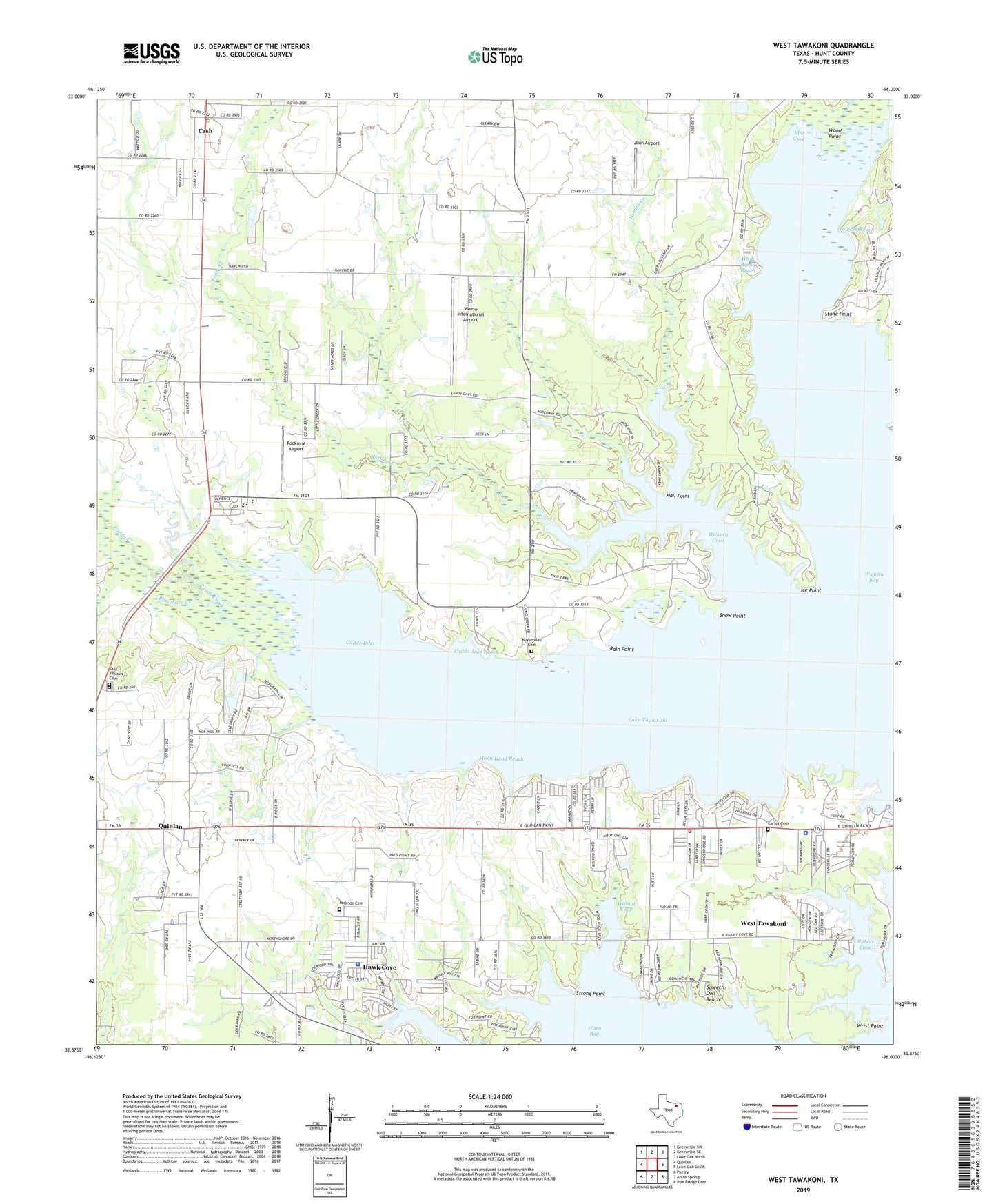
2022 topographic map quadrangle West Tawakoni in the state of Texas. Scale: 1:24000. Based on the newly updated USGS 7.5' US Topo map series, this map is in the following counties: Hunt. The map contains contour data, water features, and other items you are used to seeing on USGS maps, but also has updated roads and other features. This is the next generation of topographic maps. Printed on high-quality waterproof paper with UV fade-resistant inks.
Quads adjacent to this one:
West: Quinlan
Northwest: Greenville SW
North: Greenville SE
Northeast: Lone Oak North
East: Lone Oak South
Southeast: Iron Bridge Dam
South: Ables Springs
Southwest: Poetry
This map covers the same area as the classic USGS quad with code o32096h1.
Contains the following named places: Arm Point, Bois d'arc Creek, Boles Home, Caddo Creek, Caddo Inlet, Caddo Jake Reach, Carter Cemetery, Cash, Cash Baptist Church, Cedar Creek, City of Hawk Cove, City of West Tawakoni, Cowleech Fork Sabine River, Elm Cove, Fannin Creek, Gena Mae Wishard High School, Grace Fellowship Church, Hail Point, Hawk Cove, Hawk Cove City Hall, Hickory Cove, Ice Point, Jlinn Airport, Kevin Kipper Memorial Stadium, Kuykendall Cemetery, Lakeview Alternative School, Little Creek, McBride Cemetery, Moon Head Reach, Odd Fellows Cemetery, Prior Elementary School, Rabbit Cove, Rain Point, Rainbow Point, Rockin M Airport, Screech Owl Reach, Snow Point, SRA Park, Stone Point, Strong Point, Sunset Church, Tawakoni Golf Club, Towash Reach, Walnut Cove, Weese International Airport, West Arm Park, West Tawakoni, West Tawakoni City Office, West Tawakoni Police Department, West Tawakoni Volunteer Fire Department, White Bread Reach, Wood Point, Wrist Point, ZIP Code: 75474