MyTopo
Ringgold Texas US Topo Map
Couldn't load pickup availability
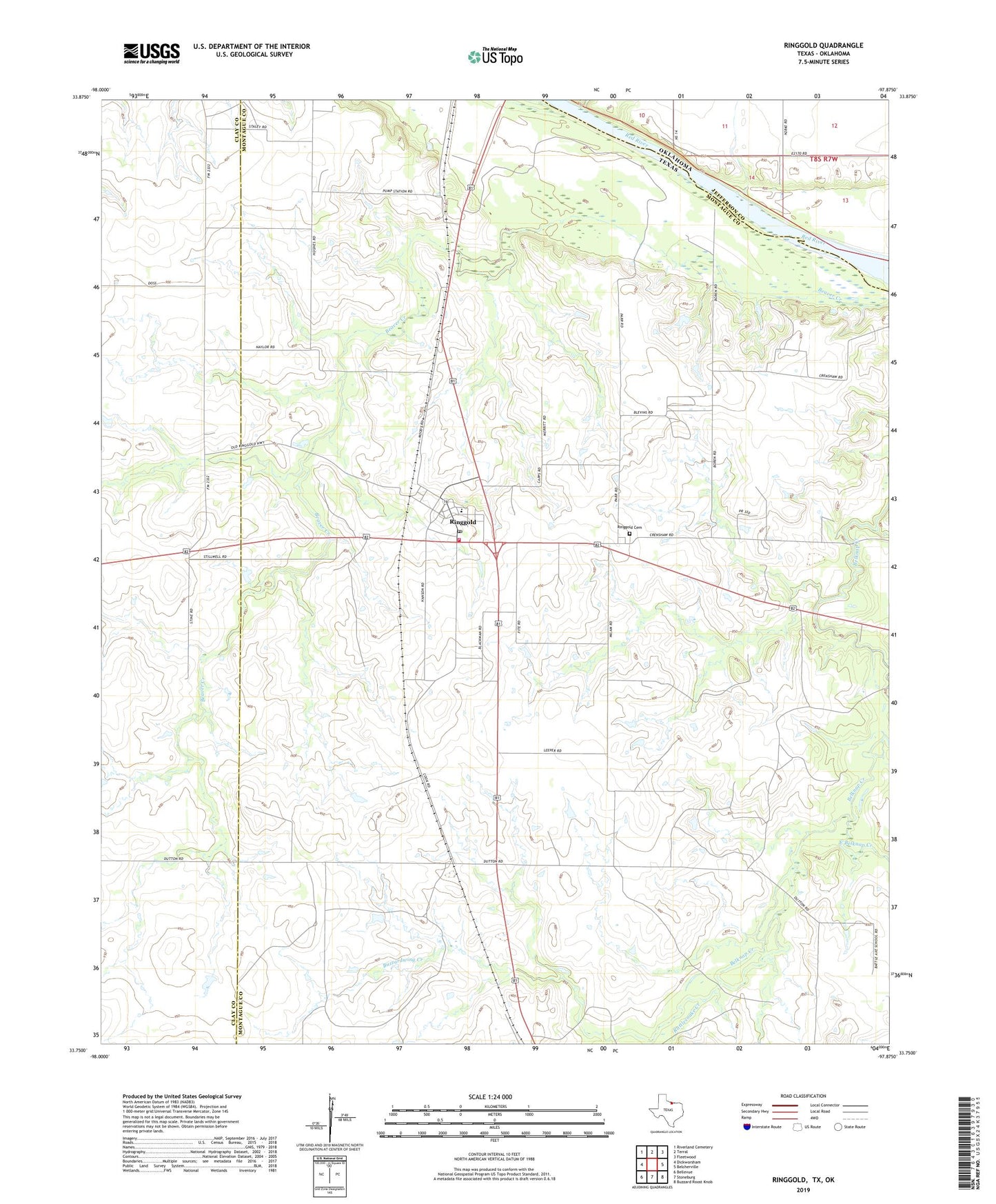
2019 topographic map quadrangle Ringgold in the state of Texas. Scale: 1:24000. Based on the newly updated USGS 7.5' US Topo map series, this map is in the following counties: Montague, Clay, Jefferson. The map contains contour data, water features, and other items you are used to seeing on USGS maps, but also has updated roads and other features. This is the next generation of topographic maps. Printed on high-quality waterproof paper with UV fade-resistant inks.
Quads adjacent to this one:
West: Dickworsham
Northwest: Riverland Cemetery
North: Terral
Northeast: Fleetwood
East: Belcherville
Southeast: Buzzard Roost Knob
South: Stoneburg
Southwest: Bellevue
Contains the following named places: Buzzardwing Creek, East Belknap Creek, Rattlesnake Creek, Ringgold, Ringgold Cemetery, Ringgold Census Designated Place, Ringgold Elementary School, Ringgold Post Office, Ringgold Volunteer Fire Department, Worsham Oil Field, ZIP Code: 76261