MyTopo
Fleetwood Oklahoma US Topo Map
Couldn't load pickup availability
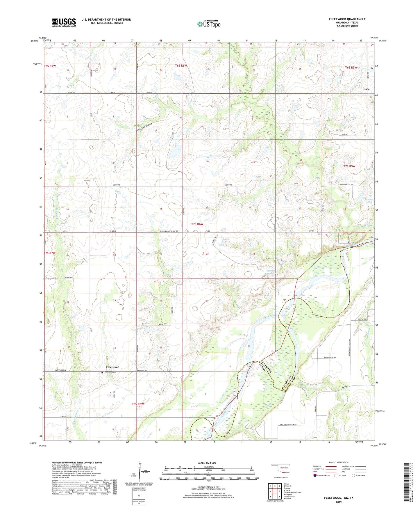
2022 topographic map quadrangle Fleetwood in the states of Oklahoma, Texas. Scale: 1:24000. Based on the newly updated USGS 7.5' US Topo map series, this map is in the following counties: Jefferson, Montague. The map contains contour data, water features, and other items you are used to seeing on USGS maps, but also has updated roads and other features. This is the next generation of topographic maps. Printed on high-quality waterproof paper with UV fade-resistant inks.
Quads adjacent to this one:
West: Terral
Northwest: Ryan
North: Ryan SE
Northeast: Grady
East: Prairie Valley School
Southeast: Nocona
South: Belcherville
Southwest: Ringgold
Contains the following named places: Cat Creek, Fleetwood, Fleetwood Cemetery, Oknoname 067013 Dam, Oknoname 067013 Reservoir, Oknoname 067014 Dam, Oknoname 067014 Reservoir, Oscar, Pecan Creek, Reagan Lake, Reagan Lake Dam, Red Creek, Salt Creek, Sam Suell Hollow, Township of Wray, ZIP Code: 73569