MyTopo
Riverland Cemetery Texas US Topo Map
Couldn't load pickup availability
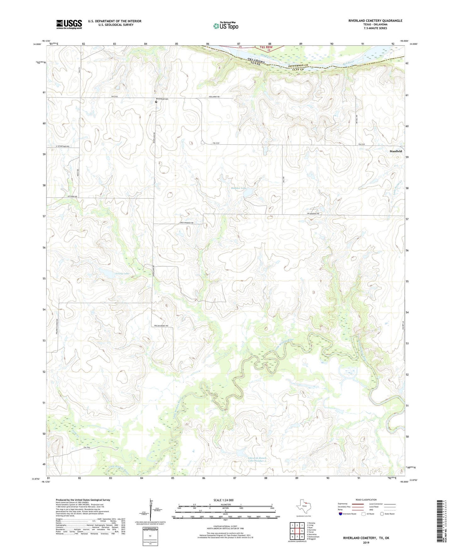
2022 topographic map quadrangle Riverland Cemetery in the state of Texas. Scale: 1:24000. Based on the newly updated USGS 7.5' US Topo map series, this map is in the following counties: Clay, Jefferson. The map contains contour data, water features, and other items you are used to seeing on USGS maps, but also has updated roads and other features. This is the next generation of topographic maps. Printed on high-quality waterproof paper with UV fade-resistant inks.
Quads adjacent to this one:
West: Hurnville
Northwest: Petrolia
North: Irving
Northeast: Ryan
East: Terral
Southeast: Ringgold
South: Dickworsham
Southwest: Henrietta
This map covers the same area as the classic USGS quad with code o33098h1.
Contains the following named places: East Fork Little Wichita River, Edwards Ranch Lake Number 2, Edwards Ranch Lake Number 2 Dam, Lively Lake, Lively Lake Dam, Long Creek, Maddox Lake, Maddox Lake Dam, Riverland Cemetery