MyTopo
Rio Frio Texas US Topo Map
Couldn't load pickup availability
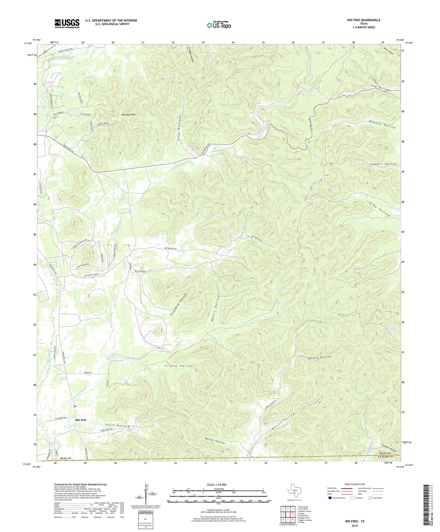
2019 topographic map quadrangle Rio Frio in the state of Texas. Scale: 1:24000. Based on the newly updated USGS 7.5' US Topo map series, this map is in the following counties: Real, Uvalde. The map contains contour data, water features, and other items you are used to seeing on USGS maps, but also has updated roads and other features. This is the next generation of topographic maps. Printed on high-quality waterproof paper with UV fade-resistant inks.
Quads adjacent to this one:
West: Leakey
Northwest: Owl Hollow
North: Circle Bluff
Northeast: Sabinal Canyon
East: Vanderpool
Southeast: Utopia
South: Magers Crossing
Southwest: Reagan Wells
Contains the following named places: Bailey Hollow, Beard Hollow, Casey Three Ranch Airport, Deep Creek, Deer Creek, Dry Branch, East Frio River, Flat Creek, Franklin Hollow, Friday Hollow, Harrison Lake, Harrison Lake Dam, Little Dry Frio Creek, Long Hollow, Massey Hollow, Meridian Mountain, Moore Hollow, Morris Hollow, Mud Spring, Panther Springs, Pole Hollow, Ringhorn Hollow, Rio Frio, Rio Frio Post Office, West Frio River, ZIP Code: 78879