MyTopo
Sabinal Canyon Texas US Topo Map
Couldn't load pickup availability
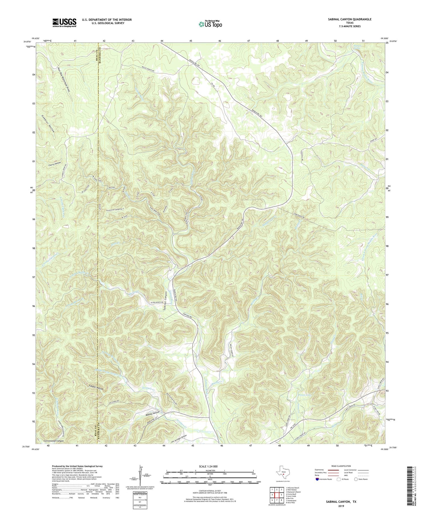
2022 topographic map quadrangle Sabinal Canyon in the state of Texas. Scale: 1:24000. Based on the newly updated USGS 7.5' US Topo map series, this map is in the following counties: Bandera, Real. The map contains contour data, water features, and other items you are used to seeing on USGS maps, but also has updated roads and other features. This is the next generation of topographic maps. Printed on high-quality waterproof paper with UV fade-resistant inks.
Quads adjacent to this one:
West: Circle Bluff
Northwest: Hillcrest Ranch
North: Well Hollow
Northeast: Diamond S Ranch
East: Love Creek
Southeast: Seco Pass
South: Vanderpool
Southwest: Rio Frio
This map covers the same area as the classic USGS quad with code o29099g5.
Contains the following named places: Brushy Creek, Can Creek, Dry Can Creek, Evans Creek, Fiddler Hollow, Flatrock Spring, Jim Jernigan Hollow, Lost Maples State Natural Area, Lost Maples State Natural Area Trails, Marler Creek, Massey Hollow, Middle Prong Jerigan Creek, North Prong Jernigan Creek, North Prong Marler Creek, Pelaez Lake, Pelaez Lake Dam, Post Oak Waterhole, Sabinal Canyon, Snow Creek, South Prong Marler Creek, Wedgeworth Creek, Willow Springs Branch, ZIP Code: 78885