MyTopo
Robbers Roost Texas US Topo Map
Couldn't load pickup availability
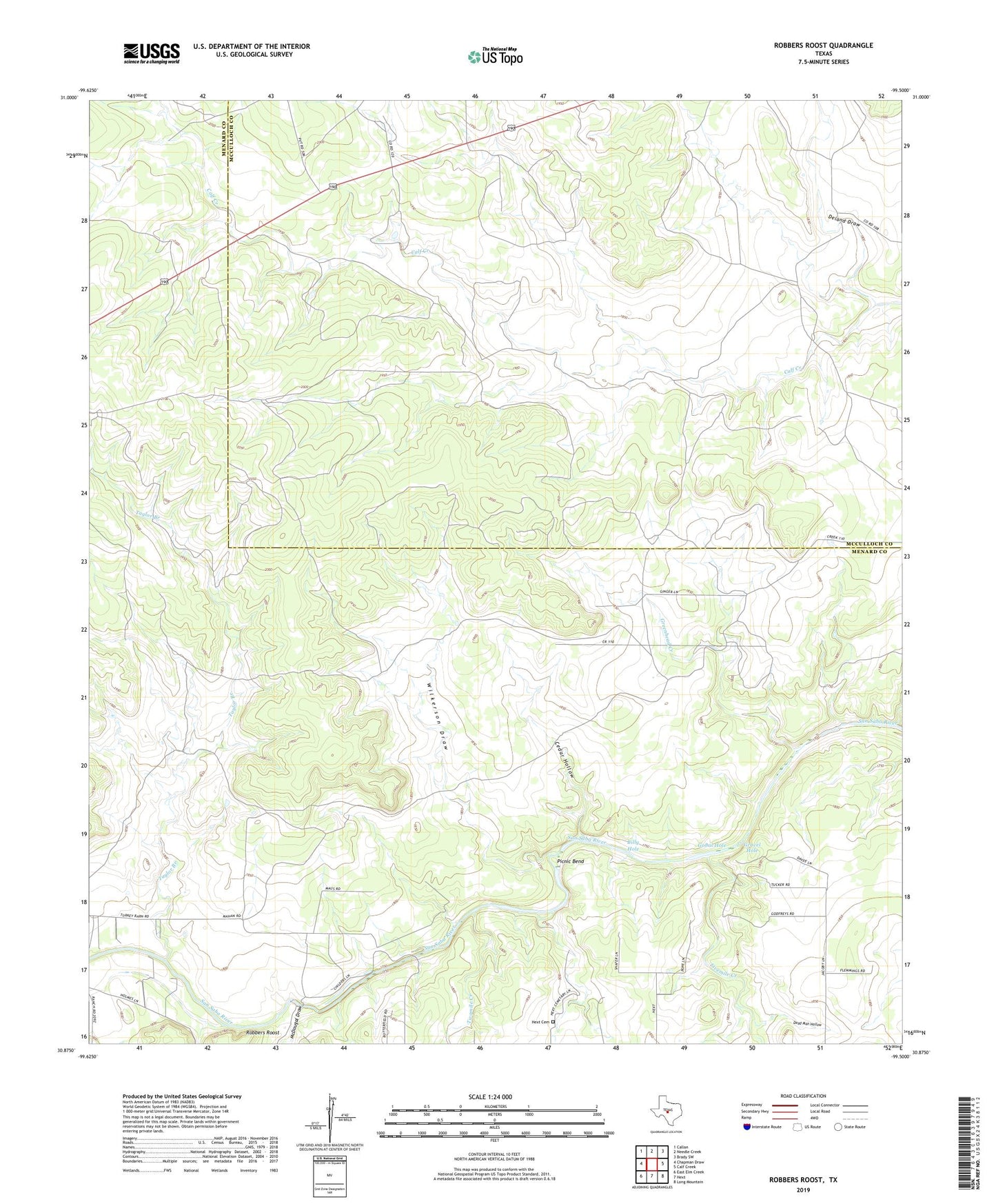
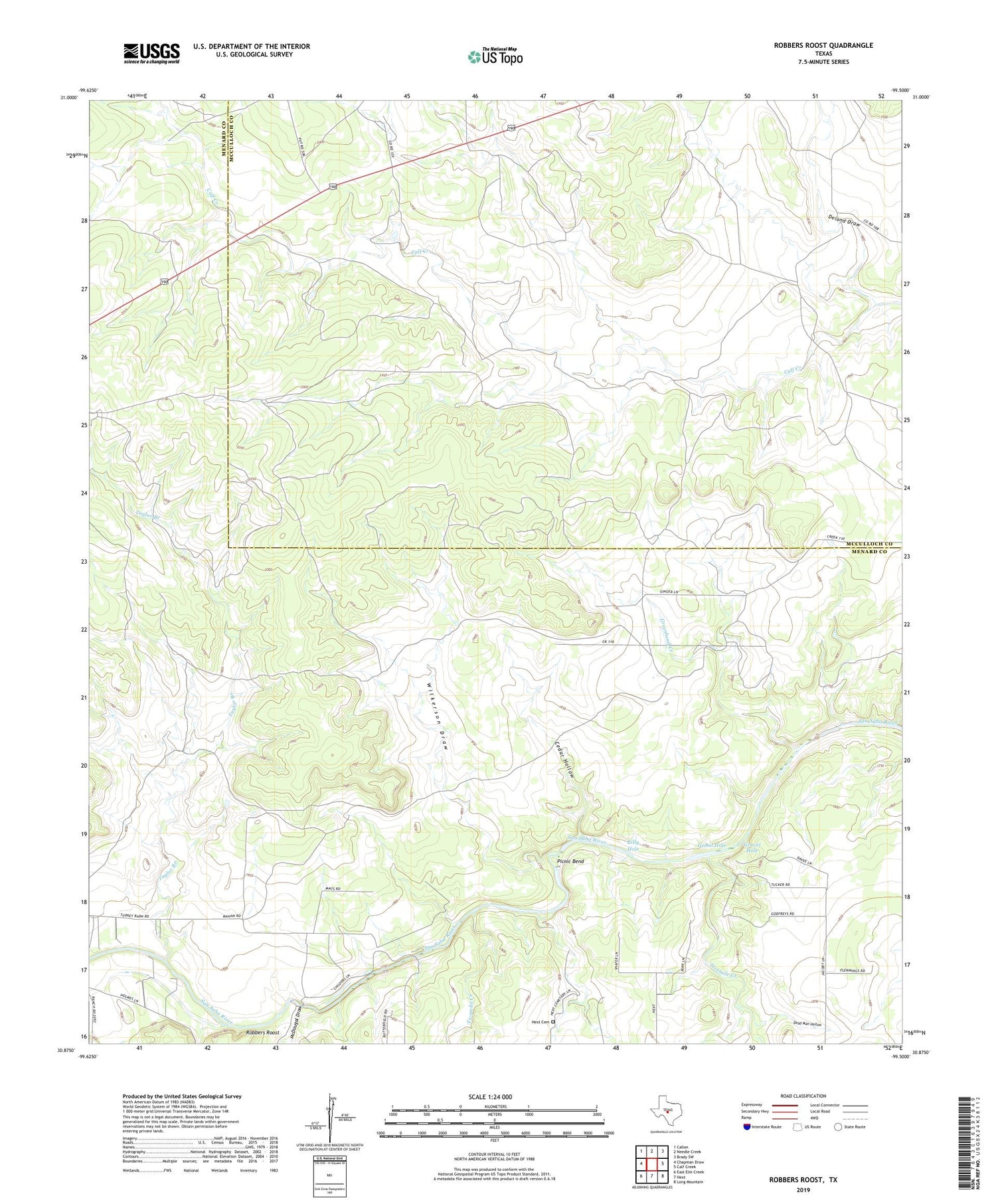
2019 topographic map quadrangle Robbers Roost in the state of Texas. Scale: 1:24000. Based on the newly updated USGS 7.5' US Topo map series, this map is in the following counties: Menard, McCulloch. The map contains contour data, water features, and other items you are used to seeing on USGS maps, but also has updated roads and other features. This is the next generation of topographic maps. Printed on high-quality waterproof paper with UV fade-resistant inks.
Quads adjacent to this one:
West: Chapman Draw
Northwest: Callan
North: Needle Creek
Northeast: Brady SW
East: Calf Creek
Southeast: Long Mountain
South: Hext
Southwest: East Elm Creek
Contains the following named places: Billy Hole, Cedar Hollow, Dead Man Hollow, Deland Draw, Fivemile Creek, Gobal Hole, Gravel Hole, Greenhead Creek, Hext Cemetery, McDougal Draw, Picnic Bend, Robbers Roost, Taylor Branch, Twomile Creek, Wilkerson Draw