MyTopo
Calf Creek Texas US Topo Map
Couldn't load pickup availability
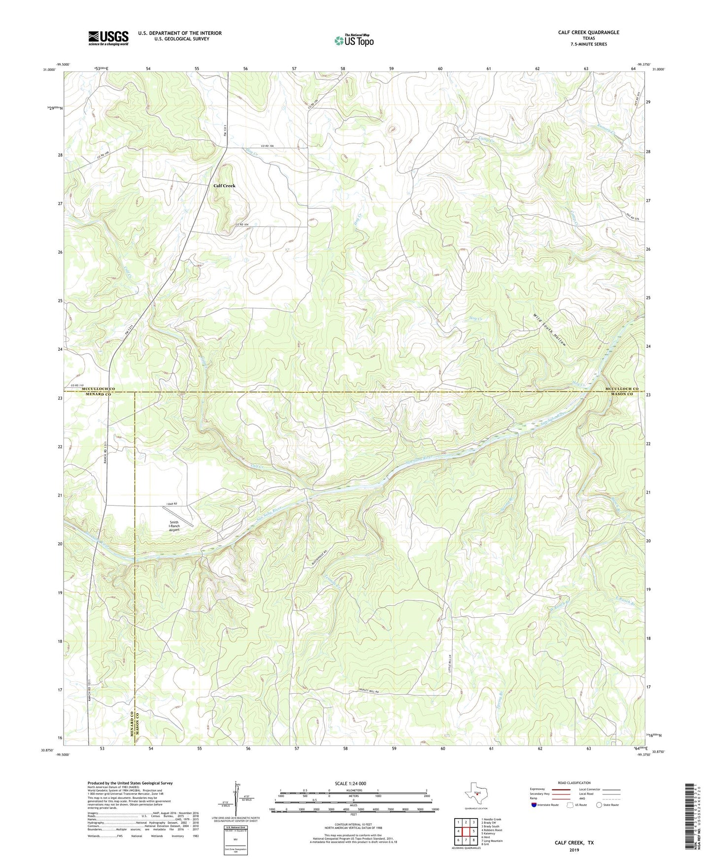
2022 topographic map quadrangle Calf Creek in the state of Texas. Scale: 1:24000. Based on the newly updated USGS 7.5' US Topo map series, this map is in the following counties: McCulloch, Mason, Menard. The map contains contour data, water features, and other items you are used to seeing on USGS maps, but also has updated roads and other features. This is the next generation of topographic maps. Printed on high-quality waterproof paper with UV fade-resistant inks.
Quads adjacent to this one:
West: Robbers Roost
Northwest: Needle Creek
North: Brady SW
Northeast: Brady South
East: Katemcy
Southeast: Grit
South: Long Mountain
Southwest: Hext
This map covers the same area as the classic USGS quad with code o30099h4.
Contains the following named places: Block House Ranch, Blue Hole, Calf Creek, East Ranch Branch, Hog Creek, Ranch Branch, Smith I-Ranch Airport, Spring Branch, Tenmile Creek, Twentymile Crossing, West Ranch Branch, Wild South Hollow