MyTopo
Needle Creek Texas US Topo Map
Couldn't load pickup availability
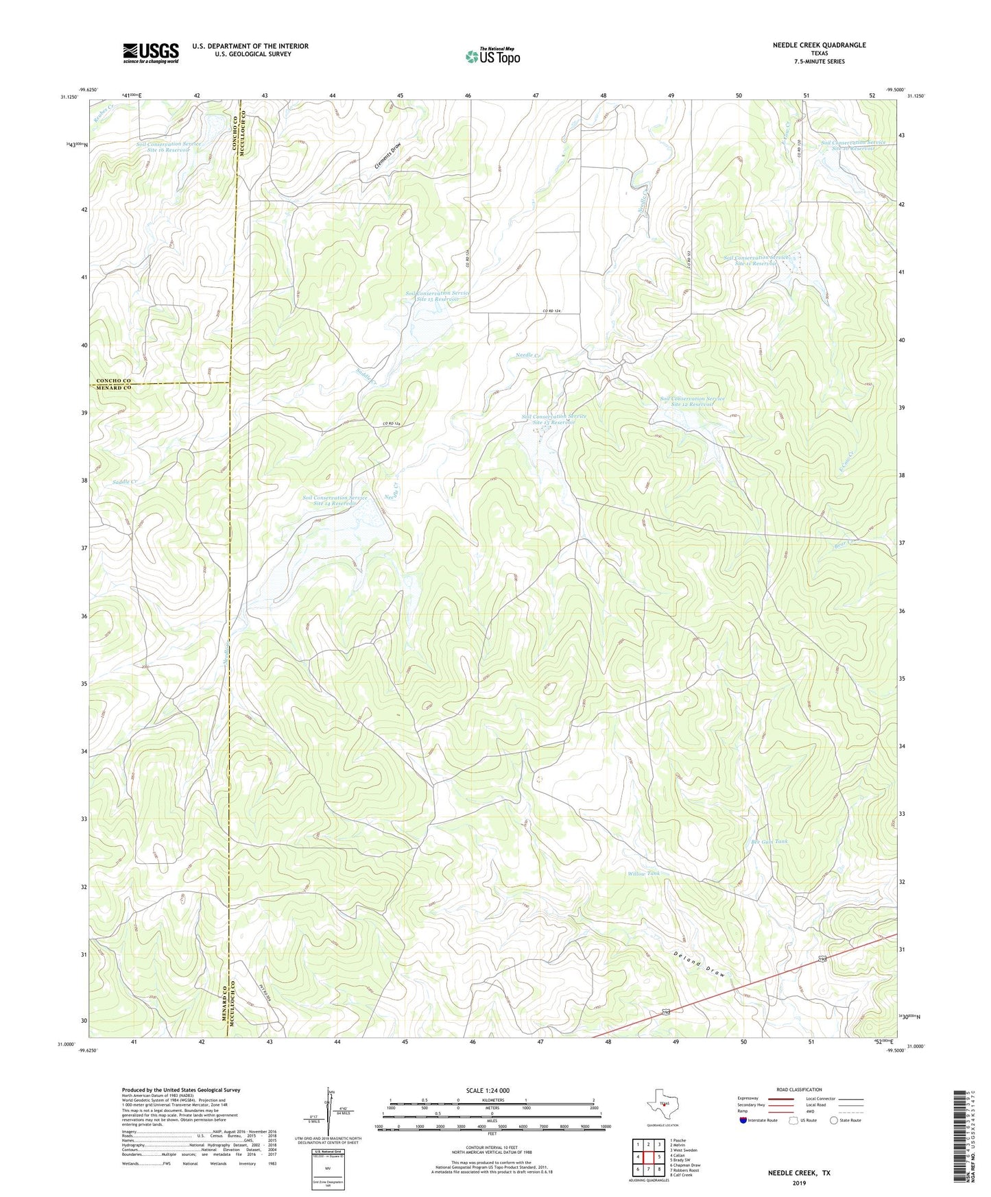
2022 topographic map quadrangle Needle Creek in the state of Texas. Scale: 1:24000. Based on the newly updated USGS 7.5' US Topo map series, this map is in the following counties: McCulloch, Menard, Concho. The map contains contour data, water features, and other items you are used to seeing on USGS maps, but also has updated roads and other features. This is the next generation of topographic maps. Printed on high-quality waterproof paper with UV fade-resistant inks.
Quads adjacent to this one:
West: Callan
Northwest: Pasche
North: Melvin
Northeast: West Sweden
East: Brady SW
Southeast: Calf Creek
South: Robbers Roost
Southwest: Chapman Draw
This map covers the same area as the classic USGS quad with code o31099a5.
Contains the following named places: Bee Gum Tank, Ford Ranch, Soil Conservation Service Site 10 Dam, Soil Conservation Service Site 10 Reservoir, Soil Conservation Service Site 11 Dam, Soil Conservation Service Site 11 Reservoir, Soil Conservation Service Site 12 Dam, Soil Conservation Service Site 12 Reservoir, Soil Conservation Service Site 13 Dam, Soil Conservation Service Site 13 Reservoir, Soil Conservation Service Site 14 Dam, Soil Conservation Service Site 14 Reservoir, Soil Conservation Service Site 15 Dam, Soil Conservation Service Site 15 Reservoir, Soil Conservation Service Site 16 Dam, Soil Conservation Service Site 16 Reservoir, Willow Tank