MyTopo
Rockdale West Texas US Topo Map
Couldn't load pickup availability
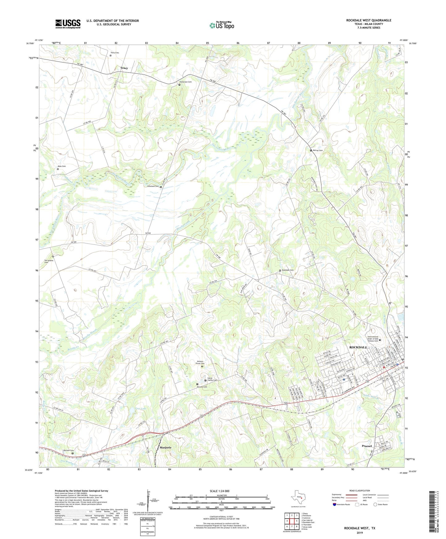
2019 topographic map quadrangle Rockdale West in the state of Texas. Scale: 1:24000. Based on the newly updated USGS 7.5' US Topo map series, this map is in the following counties: Milam. The map contains contour data, water features, and other items you are used to seeing on USGS maps, but also has updated roads and other features. This is the next generation of topographic maps. Printed on high-quality waterproof paper with UV fade-resistant inks.
Quads adjacent to this one:
West: San Gabriel
Northwest: Sharp
North: Pettibone
Northeast: Cameron
East: Rockdale East
Southeast: Hicks
South: Alcoa Lake
Southwest: Thorndale
Contains the following named places: Alligator Creek, American Medical Response Ambulance Service Station 2, Bethlehem School, Browns Cemetery, Brushy Creek, Brushy Slough, Bushdale Cemetery, Church of Christ, Church of Christ West Bell, City of Rockdale, Davison Cemetery, Dry Brushy Creek, East Ham Branch, Fair Park, Fair Park Racetrack, First Presbyterian Church, First United Pentecostal Church, Garza Cemetery, Gilleland Cemetery, Handy, Hickory Grove Cemetery, International Order of Odd Fellows Cemetery, KRXT-FM (Rockdale), Little Ham Branch, Little River Healthcare Rockdale Hospital, Marjorie, Meadow Brook Church, Meadowbrook Baptist Church, Moss Cemetery, Murray Cemetery, Praesel, Praesel Census Designated Place, Primera Iglesia Bautista Church, Rockdale, Rockdale Branch, Rockdale City Hall, Rockdale Elementary School, Rockdale High School, Rockdale Junior High School, Rockdale Police Department, Rockdale Post Office, Rockdale Volunteer Fire Department, Rocky Creek, Saint Johns Church, Saint Thomas Episcopal Church, San Andres Cemetery, Sanders Branch, Tracy, Tracy Cemetery, Voss Lake, Voss Lake Dam, West Ham Branch, ZIP Code: 76567