MyTopo
Hicks Texas US Topo Map
Couldn't load pickup availability
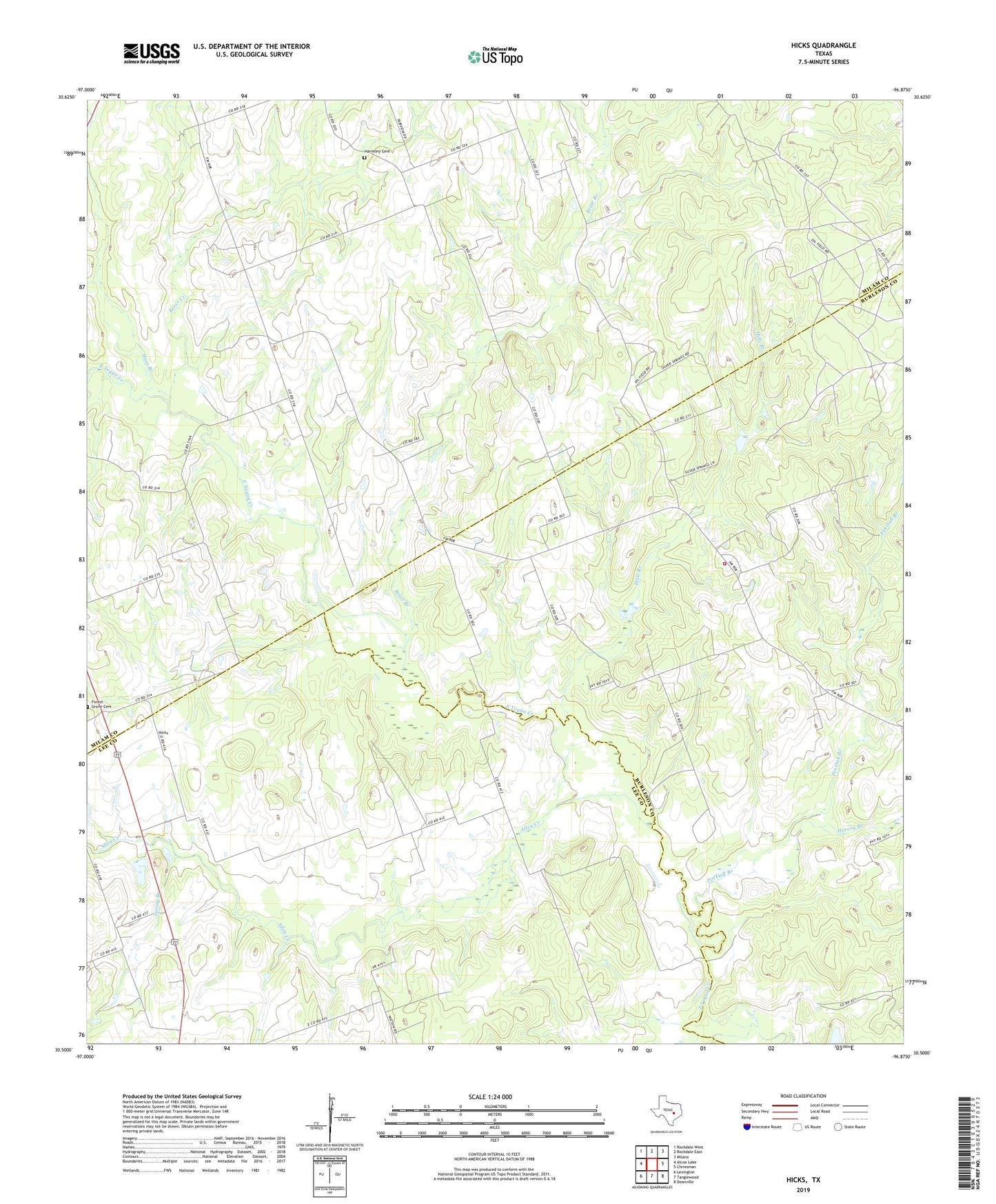
2022 topographic map quadrangle Hicks in the state of Texas. Scale: 1:24000. Based on the newly updated USGS 7.5' US Topo map series, this map is in the following counties: Milam, Burleson, Lee. The map contains contour data, water features, and other items you are used to seeing on USGS maps, but also has updated roads and other features. This is the next generation of topographic maps. Printed on high-quality waterproof paper with UV fade-resistant inks.
Quads adjacent to this one:
West: Alcoa Lake
Northwest: Rockdale West
North: Rockdale East
Northeast: Milano
East: Chriesman
Southeast: Deanville
South: Tanglewood
Southwest: Lexington
This map covers the same area as the classic USGS quad with code o30096e8.
Contains the following named places: Allen Creek, Black Jack Church, Black Jack Volunteer Fire Department, Briar Branch, Forest Grove, Forest Grove Church, Ham Branch, Harmony Cemetery, Harvey Branch, Hicks, Hicks Mine, Hills Branch, Pin Oak Branch, Reece Creek, Spring Branch