MyTopo
Alcoa Lake Texas US Topo Map
Couldn't load pickup availability
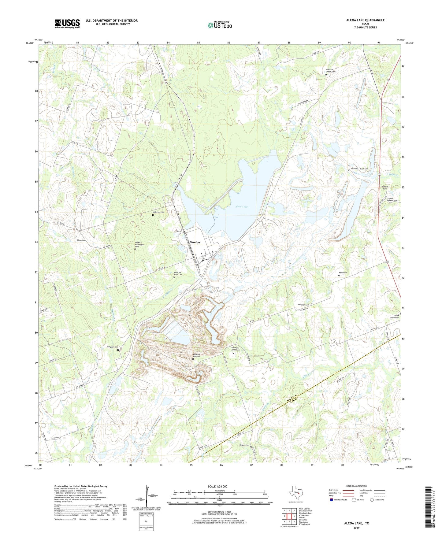
2022 topographic map quadrangle Alcoa Lake in the state of Texas. Scale: 1:24000. Based on the newly updated USGS 7.5' US Topo map series, this map is in the following counties: Milam, Lee. The map contains contour data, water features, and other items you are used to seeing on USGS maps, but also has updated roads and other features. This is the next generation of topographic maps. Printed on high-quality waterproof paper with UV fade-resistant inks.
Quads adjacent to this one:
West: Thorndale
Northwest: San Gabriel
North: Rockdale West
Northeast: Rockdale East
East: Hicks
Southeast: Tanglewood
South: Lexington
Southwest: Beaukiss
This map covers the same area as the classic USGS quad with code o30097e1.
Contains the following named places: Alcoa, Alcoa Dam, Alcoa Lake, Barber Cemetery, Beulah Cemetery, Bingham Cemetery, Bryant - Massinggill Cemetery, Crayton - Richards Cemetery, Forest Grove Cemetery, Hamilton Chapel Cemetery, Holliman Cemetery, Keen Cemetery, Miller Cemetery, Millerton Cemetery, Oliver Cemetery, Pleasant Hill, Pleasant Hill Cemetery, Richards - Black Cemetery, Richards Cemetery, Rouse Branch, Sandow, Simmons - Jones Cemetery, Waddle Cemetery, Watson Branch