MyTopo
Sharp Texas US Topo Map
Couldn't load pickup availability
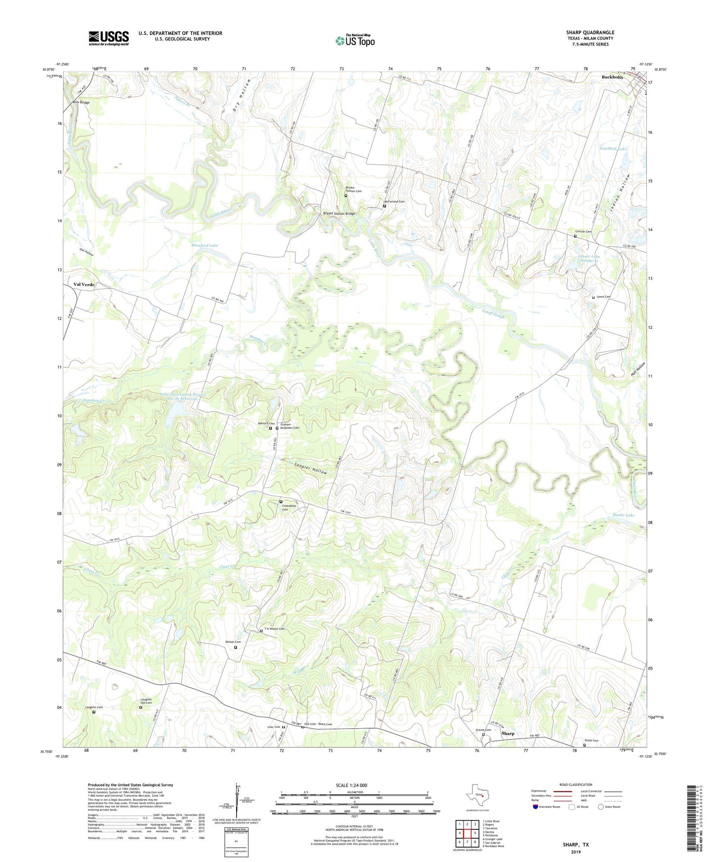
2022 topographic map quadrangle Sharp in the state of Texas. Scale: 1:24000. Based on the newly updated USGS 7.5' US Topo map series, this map is in the following counties: Milam. The map contains contour data, water features, and other items you are used to seeing on USGS maps, but also has updated roads and other features. This is the next generation of topographic maps. Printed on high-quality waterproof paper with UV fade-resistant inks.
Quads adjacent to this one:
West: Davilla
Northwest: Little River
North: Rogers
Northeast: Yarrelton
East: Pettibone
Southeast: Rockdale West
South: San Gabriel
Southwest: Granger Lake
This map covers the same area as the classic USGS quad with code o30097g2.
Contains the following named places: Anderson Branch, Bentsch Cemetery, Bryant Station Bridge, Bryant Station Cemetery, Buckholts Town Hall, Clays Creek, Corinth, Corinth Cemetery, Cummins Crossing, Cutoff Slough, Davilla Division, Donahoe Creek, Dotson Cemetery, Dry Hollow, Friendship Cemetery, Friendship Church, Glaser Lake Number 2, Glaser Lake Number 2 Dam, Graham - McQween Cemetery, Graves Cemetery, Hall Hollow, Hanke Lake, Indian Hollow, Laughlin Cemetery, Laughlin Old Cemetery, Lewis Cemetery, Lilac Cemetery, Lilac Church, Liveoak Church, McFarland Cemetery, Mumford Lake, Old Lilac - Black Cemetery, Owl Hollow, Sanpier Hollow, Sharp, Sharp Springs, Soil Conservation Service Site 10 Dam, Soil Conservation Service Site 10 Reservoir, Sypert Branch, T K Wilson Cemetery, Taplin View Cemetery, Tomascik Lake, Tomascik Lake Dam, Town of Buckholts, Val Verde, Wire Bridge, Wolf Branch, ZIP Code: 76518