MyTopo
Roxton Texas US Topo Map
Couldn't load pickup availability
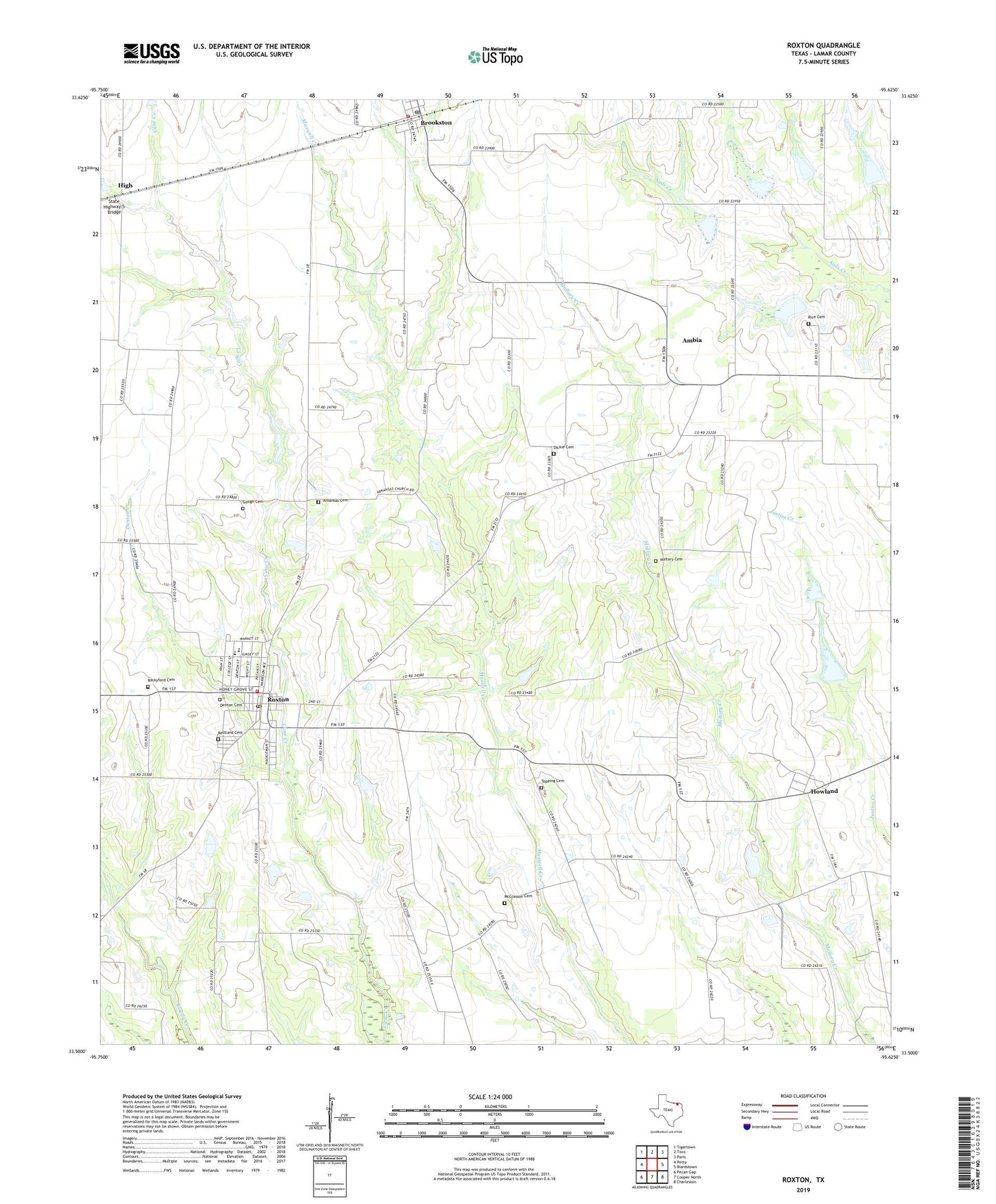
2019 topographic map quadrangle Roxton in the state of Texas. Scale: 1:24000. Based on the newly updated USGS 7.5' US Topo map series, this map is in the following counties: Lamar. The map contains contour data, water features, and other items you are used to seeing on USGS maps, but also has updated roads and other features. This is the next generation of topographic maps. Printed on high-quality waterproof paper with UV fade-resistant inks.
Quads adjacent to this one:
West: Petty
Northwest: Tigertown
North: Toco
Northeast: Paris
East: Biardstown
Southeast: Charleston
South: Cooper North
Southwest: Pecan Gap
Contains the following named places: Ambia, Ambia School, Arkansas Cemetery, Brookston, Brookston Census Designated Place, Brookston Post Office, Brookston Volunteer Fire Department - First Responders, City of Roxton, Delmar School, Denton Cemetery, Denton Creek, Dickie Cemetery, Flying Tigers Museum, Harrington North Lake, Harrington North Lake Dam, Harrington South Lake, Harrington South Lake Dam, High, Howland, Howland Division, Killingsworth Cemetery, Mallory Cemetery, McGlasson Cemetery, Oklahoma School, Pleasant Valley School, Restland Cemetery, Rice Cemetery, Rockyford Cemetery, Roxton, Roxton City Hall, Roxton Elementary School, Roxton High School, Roxton Junior High School, Roxton Post Office, Roxton Volunteer Fire Department, Soil Conservation Service Site 1 Dam, Soil Conservation Service Site 2 Dam, Soil Conservation Service Site 2 Reservoir, Soil Conservation Service Site 3 Dam, Soil Conservation Service Site 3 Reservoir, Soil Conservation Service Site 4 Dam, Soil Conservation Service Site 4 Reservoir, Soil Conservation Service Site 5 Dam, Soil Conservation Service Site 5 Reservoir, Soil Conservation Service Site I Reservoir, State Highway 5 Bridge, Toppings Cemetery, ZIP Code: 75477