MyTopo
San Juan SE Texas US Topo Map
Couldn't load pickup availability
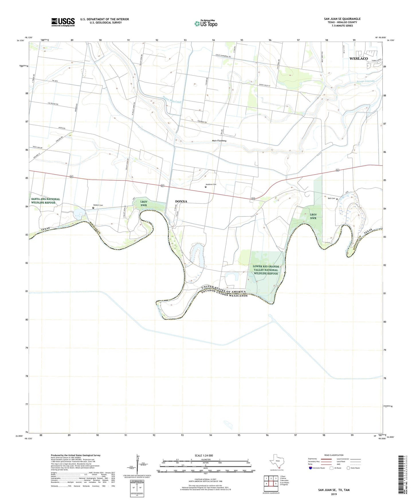
2022 topographic map quadrangle San Juan SE in the state of Texas. Scale: 1:24000. Based on the newly updated USGS 7.5' US Topo map series, this map is in the following counties: Hidalgo. The map contains contour data, water features, and other items you are used to seeing on USGS maps, but also has updated roads and other features. This is the next generation of topographic maps. Printed on high-quality waterproof paper with UV fade-resistant inks.
Quads adjacent to this one:
West: Las Milpas
Northwest: Pharr
North: Donna
Northeast: Mercedes
East: Progreso
This map covers the same area as the classic USGS quad with code o26098a1.
Contains the following named places: 9 North-East FM 493 Colonia, Asadores Cemetery, Balli Cemetery, City of Donna, Donna Main Canal, Donna Pump, Donna Pumping Station, Eurestes Banco Number 35, KNVO-TV (McAllen), La Bonitas Banco Number 37, La Cruz Resaca, Landa Gas Field, Las Palomas Wildlife Management Area - Baird Unit, Las Palomas Wildlife Management Area - Champion Unit, Las Palomas Wildlife Management Area - Chapote Unit, Las Palomas Wildlife Management Area - McManus Unit, Las Palomas Wildlife Management Area - Taormina Unit, Longoria Banco Number 39, Monterrey Banco Number 89, Pena Flora Banco Number 106, Puertas Verdes Banco Number 36, Rancho Nuevo Banco Number 101, Ratamal Banco Number 105, Run, Runn, Runn Colonia, Runn Elementary School, San Juan del Rio Banco Number 40, Vertress Colonia, Webber Cemetery, Zolezzi Banco Number 68