MyTopo
San Pablo Texas US Topo Map
Couldn't load pickup availability
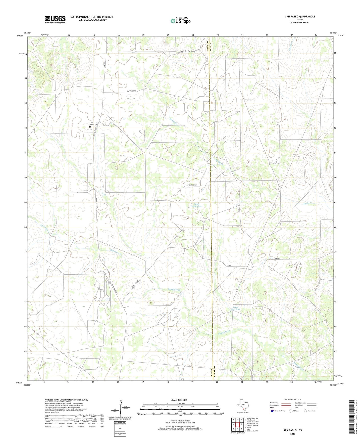
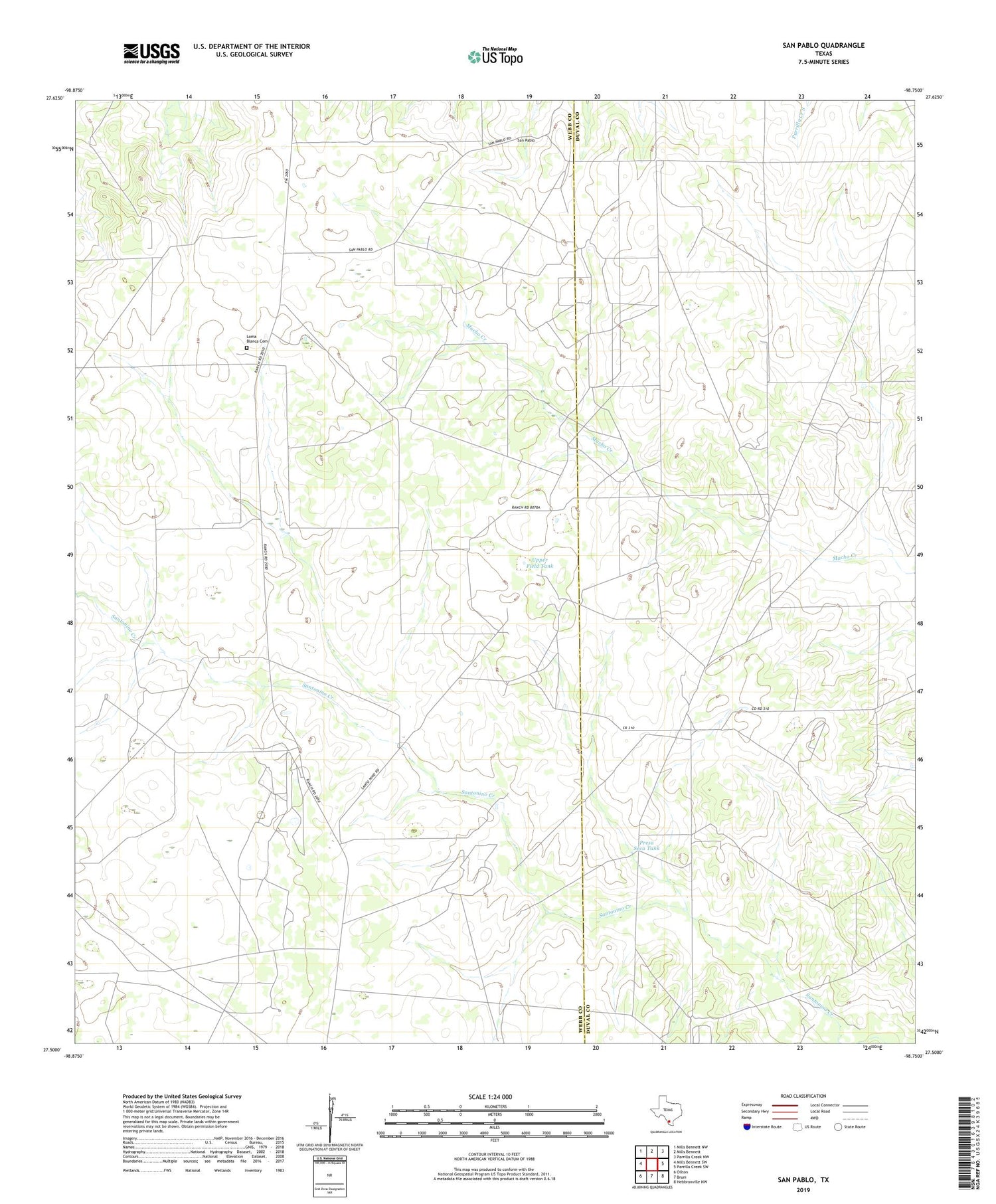
2019 topographic map quadrangle San Pablo in the state of Texas. Scale: 1:24000. Based on the newly updated USGS 7.5' US Topo map series, this map is in the following counties: Webb, Duval. The map contains contour data, water features, and other items you are used to seeing on USGS maps, but also has updated roads and other features. This is the next generation of topographic maps. Printed on high-quality waterproof paper with UV fade-resistant inks.
Quads adjacent to this one:
West: Mills Bennett SW
Northwest: Mills Bennett NW
North: Mills Bennett
Northeast: Parrilla Creek NW
East: Parrilla Creek SW
Southeast: Hebbronville NW
South: Bruni
Southwest: Oilton
Contains the following named places: Antonio Windmill, Buena Suerte Windmill, Callejon Windmill, Coma Windmill, Dinn Ranch, Horseshoe Windmill, Loma Blanca Cemetery, Middle Windmill, Muerto Windmill, Piedras China Windmill, Pila Grande Windmill, Presa Seca Tank, Red Windmill, Richardson Windmill, Ruben Windmill, San Pablo, United Windmill, Upper Field Tank, Upper Windmill, West Cole Oil Field