MyTopo
Sandia Texas US Topo Map
Couldn't load pickup availability
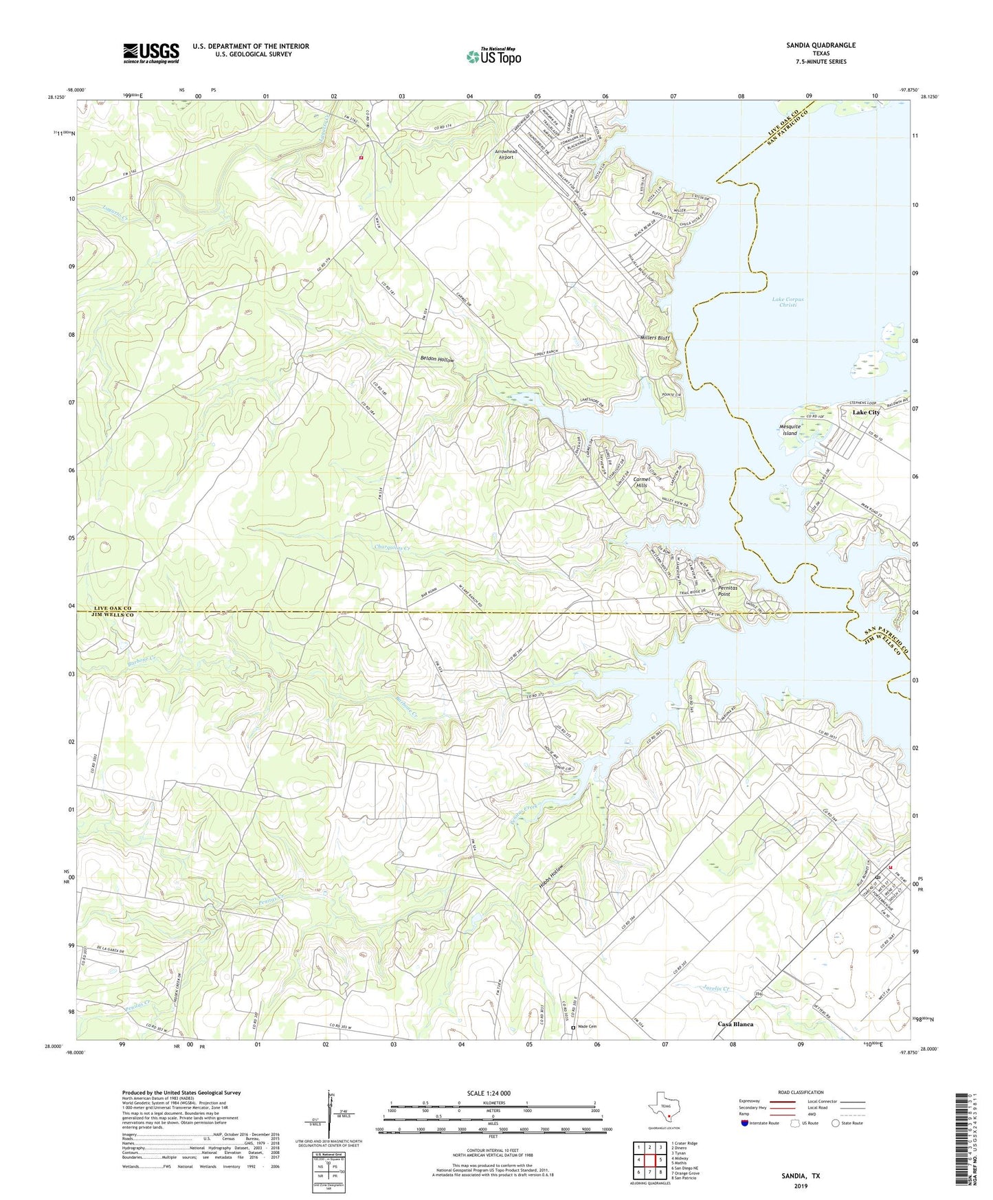
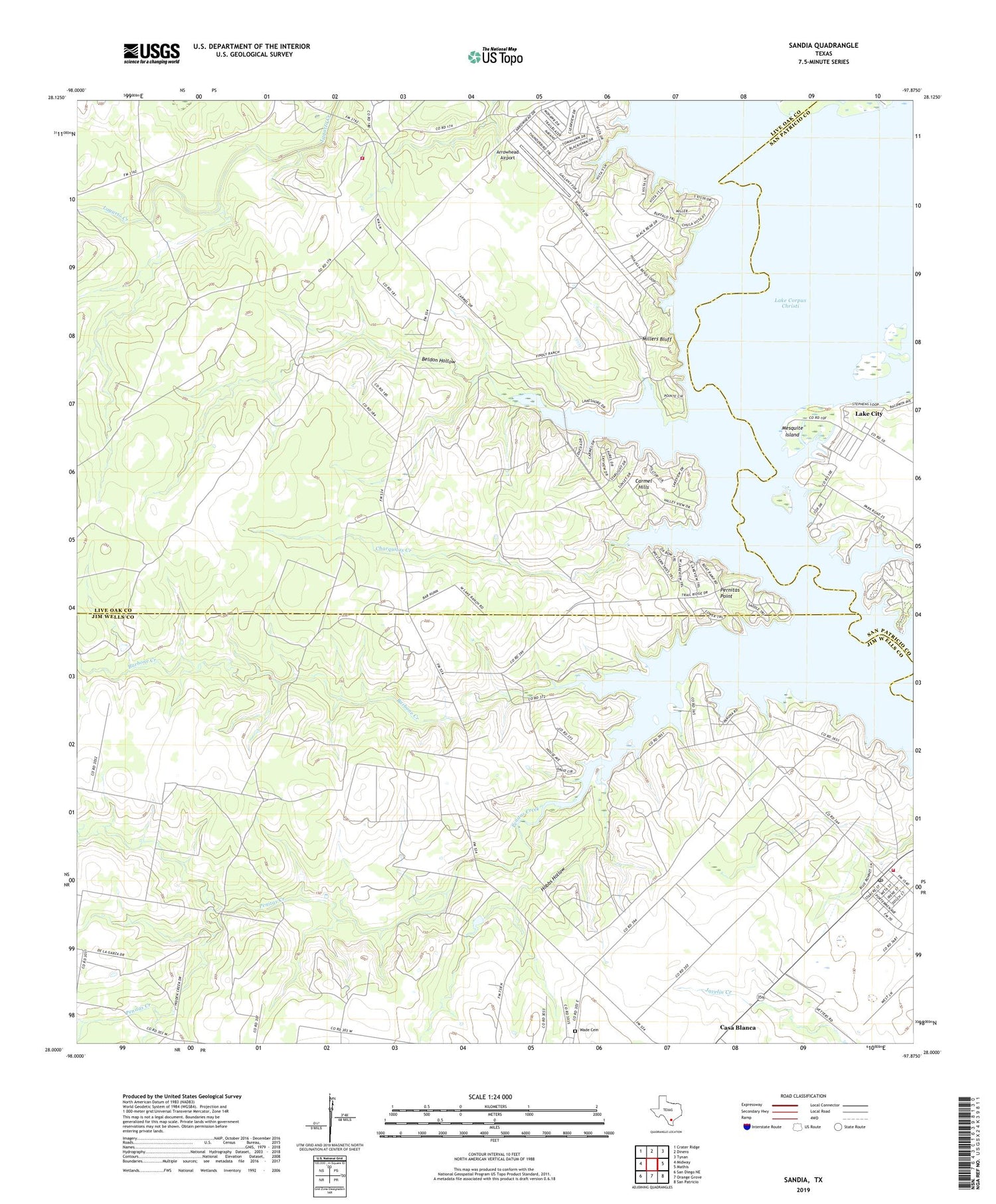
2019 topographic map quadrangle Sandia in the state of Texas. Scale: 1:24000. Based on the newly updated USGS 7.5' US Topo map series, this map is in the following counties: Jim Wells, Live Oak, San Patricio. The map contains contour data, water features, and other items you are used to seeing on USGS maps, but also has updated roads and other features. This is the next generation of topographic maps. Printed on high-quality waterproof paper with UV fade-resistant inks.
Quads adjacent to this one:
West: Midway
Northwest: Crater Ridge
North: Dinero
Northeast: Tynan
East: Mathis
Southeast: San Patricio
South: Orange Grove
Southwest: San Diego NE
Contains the following named places: Arrowhead Airport, Barbone Creek, Beldon Hollow, Camp Merrill, Carmel Hills, Casa Blanca, Charquitas Creek, Hobbs Hollow, Hodges Addition Colonia, John L Norris Colonia, Lagarto, Lagarto Volunteer Fire Department, Lake City, Lake Corpus Christi State Park, Mesquite Island, Millers Bluff, Norris Tract Number 2 Colonia, Old Casa Blanca Fort, Penitas Creek, Pernitas Point, Rozypal Estates Colonia, Sandia, Sandia Ambulance Services, Sandia Fire Department, Sandia Post Office, Town of Lake City, Village of Pernitas Point, Wade Cemetery, Wade Ranch, Wadeside Addition Colonia, Zephyr Encampment, ZIP Code: 78383