MyTopo
Sanford Texas US Topo Map
Couldn't load pickup availability
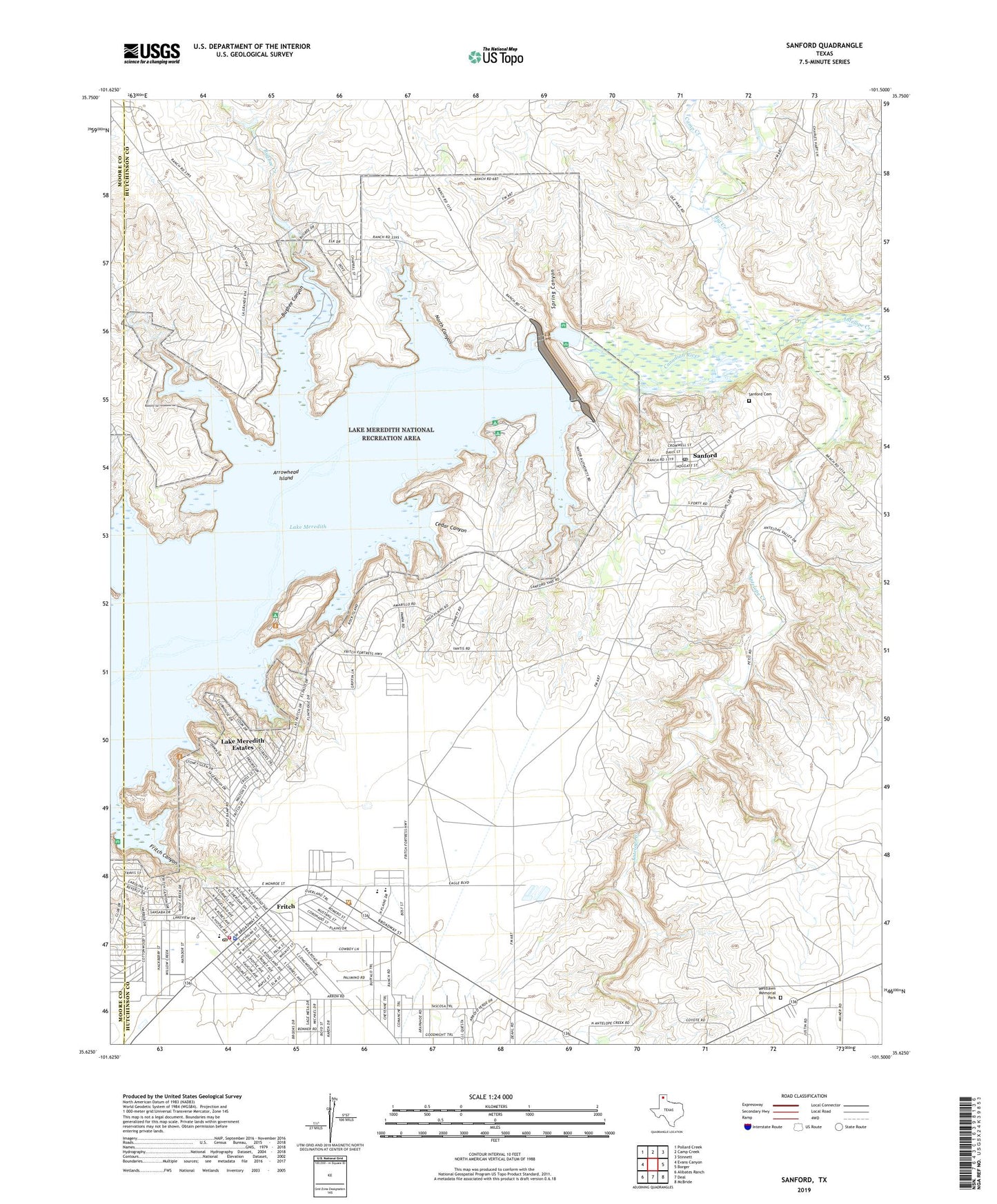
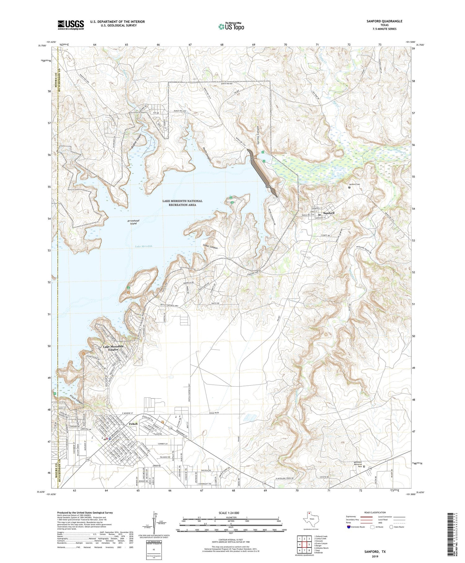
2019 topographic map quadrangle Sanford in the state of Texas. Scale: 1:24000. Based on the newly updated USGS 7.5' US Topo map series, this map is in the following counties: Hutchinson, Moore. The map contains contour data, water features, and other items you are used to seeing on USGS maps, but also has updated roads and other features. This is the next generation of topographic maps. Printed on high-quality waterproof paper with UV fade-resistant inks.
Quads adjacent to this one:
West: Evans Canyon
Northwest: Pollard Creek
North: Camp Creek
Northeast: Stinnett
East: Borger
Southeast: McBride
South: Deal
Southwest: Alibates Ranch
Contains the following named places: Arrowhead Island, Big Creek, Bugbee Canyon, Bugbee Creek, Camp Creek, Cedar Canyon, City of Fritch, Fritch, Fritch City Hall, Fritch Emergency Medical Services, Fritch Fortress Picnic Area, Fritch Police Department, Fritch Post Office, Fritch Volunteer Fire Department, Lake Meredith Aquatic and Wildlife Museum, Lake Meredith Estates Census Designated Place, North Canyon, Oil City, Sanford, Sanford - Fritch Elementary School, Sanford Cemetery, Sanford City Hall, Sanford Dam, Sanford Post Office, Sanford Recreational Area, Sanford Yake Oil Field, Spring Canyon, Town of Sanford, Turkey Creek, Westlawn Memorial Park, Yake Ranch, ZIP Code: 79078