MyTopo
Stinnett Texas US Topo Map
Couldn't load pickup availability
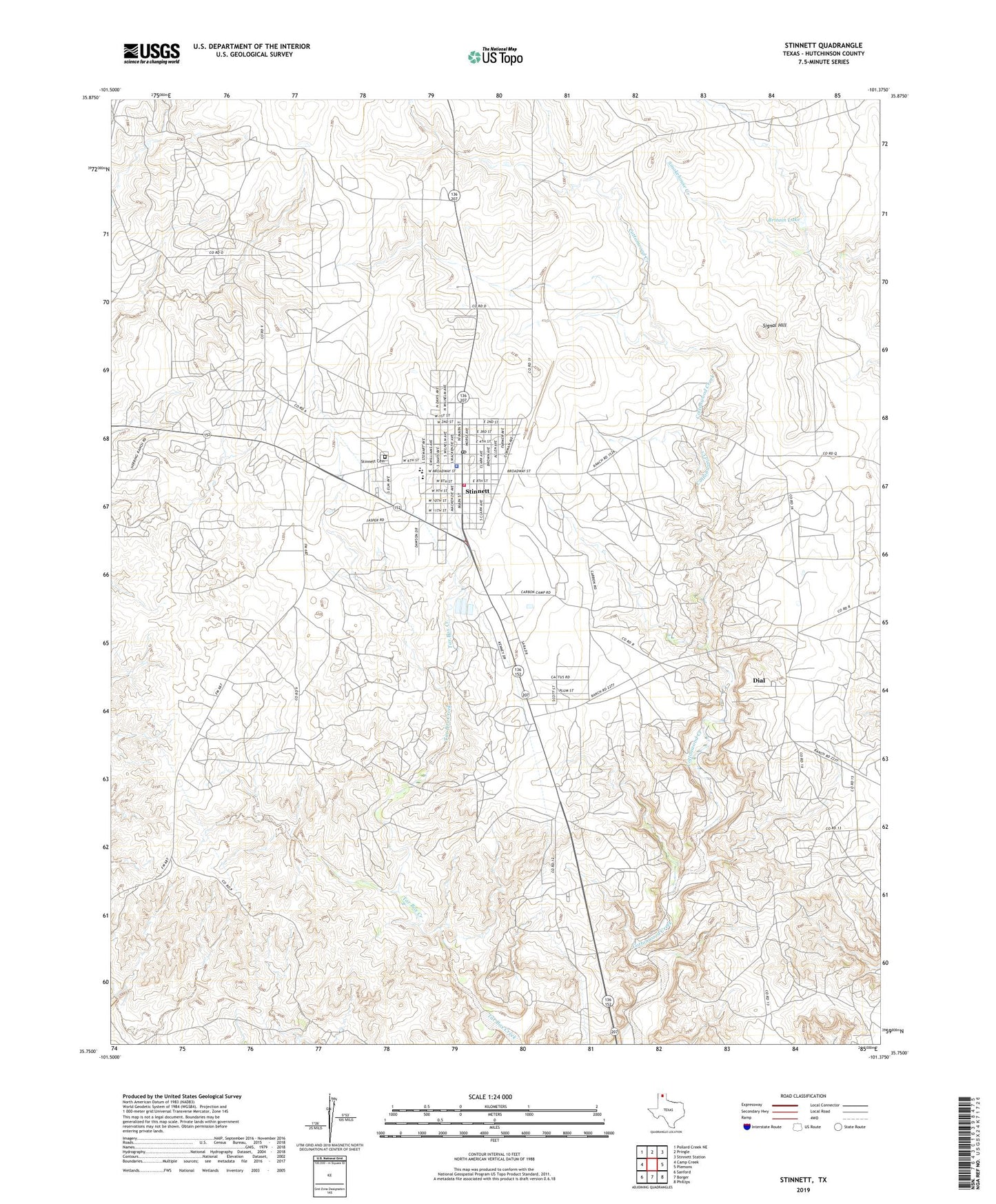
2022 topographic map quadrangle Stinnett in the state of Texas. Scale: 1:24000. Based on the newly updated USGS 7.5' US Topo map series, this map is in the following counties: Hutchinson. The map contains contour data, water features, and other items you are used to seeing on USGS maps, but also has updated roads and other features. This is the next generation of topographic maps. Printed on high-quality waterproof paper with UV fade-resistant inks.
Quads adjacent to this one:
West: Camp Creek
Northwest: Pollard Creek NE
North: Pringle
Northeast: Stinnett Station
East: Plemons
Southeast: Phillips
South: Borger
Southwest: Sanford
This map covers the same area as the classic USGS quad with code o35101g4.
Contains the following named places: Britain Lake, Britain Lake Dam, Canadian Gasoline Plant, City of Stinnett, Creslenn Camp, Dial, Hutchinson County Constable's Office Precinct 1, Johnson Pumping Station, Pantex Water System Kay Station, Signal Hill, Stekoll Camp, Stinnett, Stinnett Ambulance Service, Stinnett Cemetery, Stinnett City Hall, Stinnett Oil Field, Stinnett Police Department, Stinnett Post Office, Stinnett Volunteer Fire Department, Supreme Camp