MyTopo
Alibates Ranch Texas US Topo Map
Couldn't load pickup availability
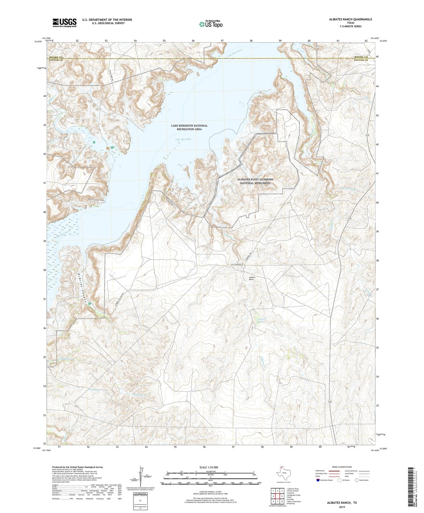
2022 topographic map quadrangle Alibates Ranch in the state of Texas. Scale: 1:24000. Based on the newly updated USGS 7.5' US Topo map series, this map is in the following counties: Potter, Moore. The map contains contour data, water features, and other items you are used to seeing on USGS maps, but also has updated roads and other features. This is the next generation of topographic maps. Printed on high-quality waterproof paper with UV fade-resistant inks.
Quads adjacent to this one:
West: McDowell Creek
Northwest: Spencer Draw
North: Evans Canyon
Northeast: Sanford
East: Deal
Southeast: Pomeroy
South: Berry Sand Draw
Southwest: Chunky
This map covers the same area as the classic USGS quad with code o35101e6.
Contains the following named places: Alibates Creek, Alibates Flint Quarries National Monument, Alibates Ranch, Bates Ramp, Bivins Camp, Coldwater Spring, Lake Meredith National Recreation Area, McBride Canyon, McBride Ranch Historical Site, North Fork Turkey Creek, Plum Creek, Plum Creek Ramp, Rock Creek, Sanford Recreation Area, Turkey Creek, Turkey Creek Plant