MyTopo
Evans Canyon Texas US Topo Map
Couldn't load pickup availability
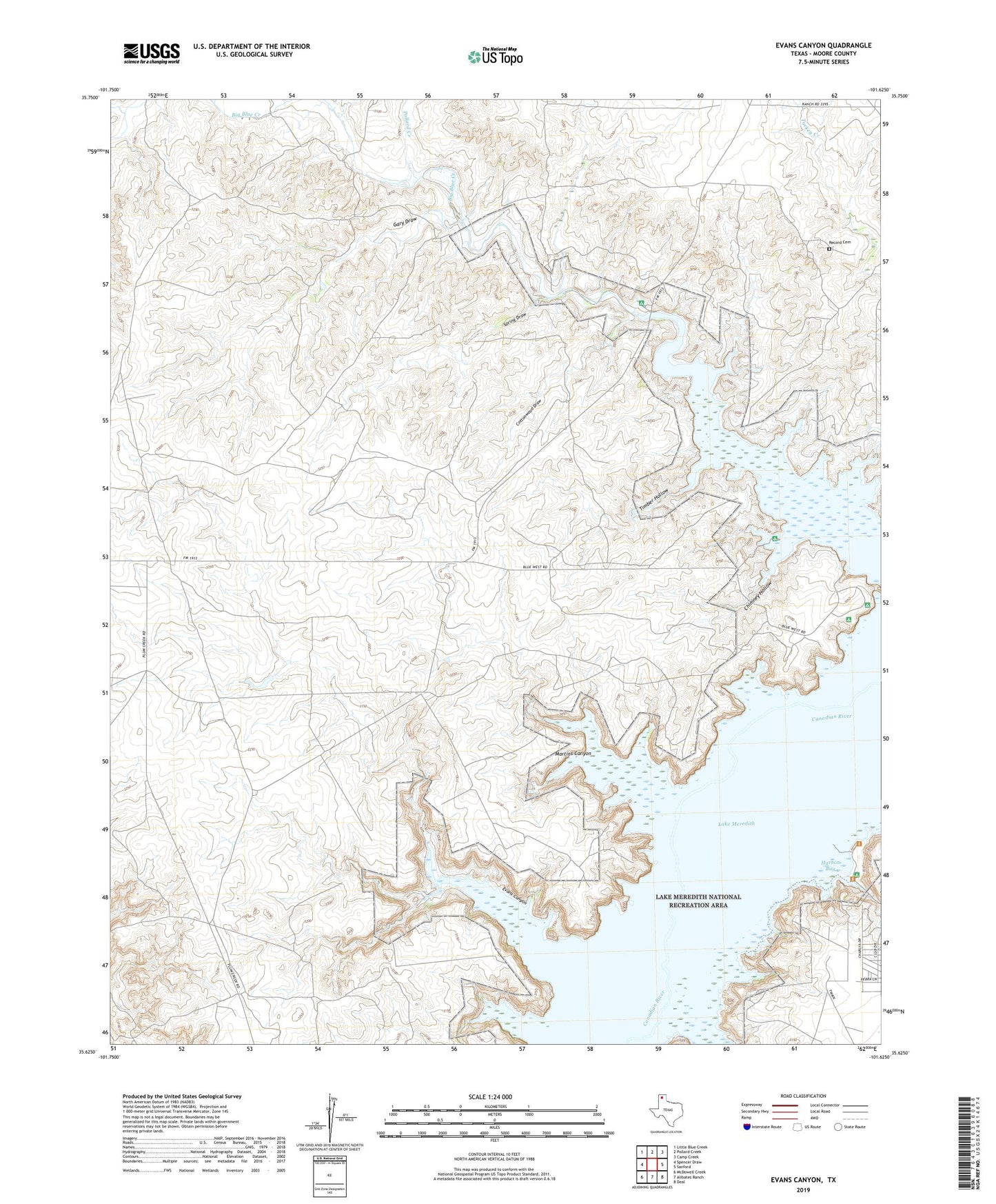
2022 topographic map quadrangle Evans Canyon in the state of Texas. Scale: 1:24000. Based on the newly updated USGS 7.5' US Topo map series, this map is in the following counties: Moore. The map contains contour data, water features, and other items you are used to seeing on USGS maps, but also has updated roads and other features. This is the next generation of topographic maps. Printed on high-quality waterproof paper with UV fade-resistant inks.
Quads adjacent to this one:
West: Spencer Draw
Northwest: Little Blue Creek
North: Pollard Creek
Northeast: Camp Creek
East: Sanford
Southeast: Deal
South: Alibates Ranch
Southwest: McDowell Creek
This map covers the same area as the classic USGS quad with code o35101f6.
Contains the following named places: Big Blue Creek, Blue West Picnic Area, Chimney Hollow, Cottonwood Draw, Evans Canyon, Fritch Canyon, Gary Draw, Harbor Bay, Lake Meredith, Martins Canyon, Pollard Creek, Record Cemetery, Record Ranch, Sand Creek, Sanford Recreational Area, Short Creek, Spring Creek, Spring Draw, Timber Hollow, Weymouth Ranch Lower Lake, Weymouth Ranch Lower Lake Dam