
MyTopo
Seeligson Ranch Texas US Topo Map
Couldn't load pickup availability
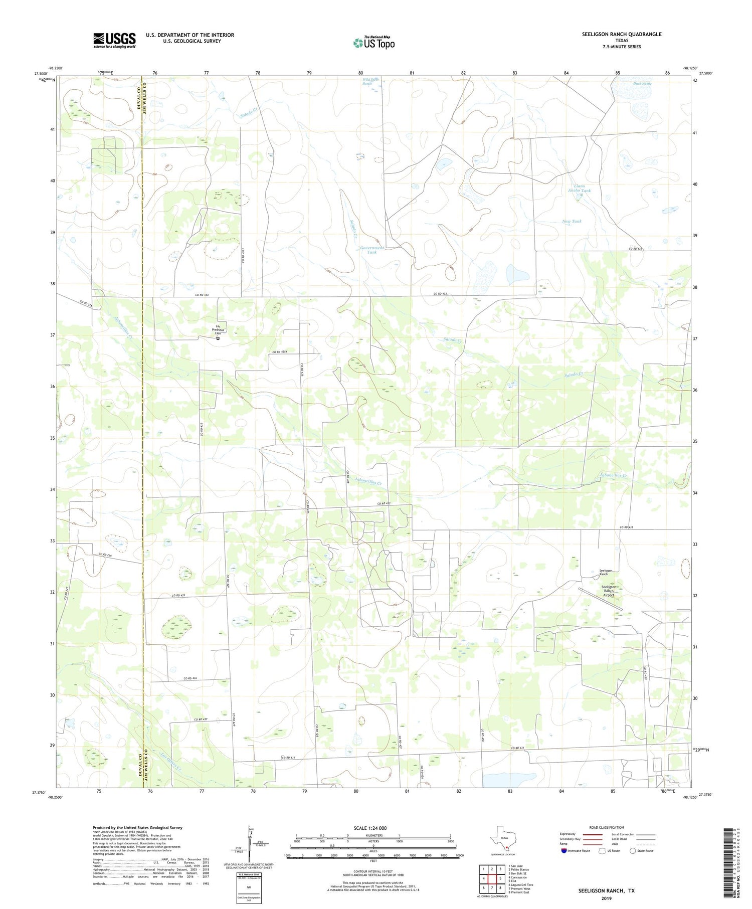
2019 topographic map quadrangle Seeligson Ranch in the state of Texas. Scale: 1:24000. Based on the newly updated USGS 7.5' US Topo map series, this map is in the following counties: Jim Wells, Duval. The map contains contour data, water features, and other items you are used to seeing on USGS maps, but also has updated roads and other features. This is the next generation of topographic maps. Printed on high-quality waterproof paper with UV fade-resistant inks.
Quads adjacent to this one:
West: Concepcion
Northwest: San Jose
North: Palito Blanco
Northeast: Ben Bolt SE
East: Ella
Southeast: Premont East
South: Premont West
Southwest: Laguna Del Toro
Contains the following named places: Agua Fria Windmill, Devisadero Windmill, Driscoll Tank, Duck Swale, East Premont Oil Field, Edwardo Windmill, Government Tank, La Patrona Windmill, Ladder Windmill, Las Piedritas Cemetery, Llano Ancho Tank, Llano Ancho Windmill, Los Jaboncillos Ranch, Moos Windmill, Narciso Windmill, New Tank, New Windmill, Ochento Windmill, Premont Oil Field, Rincon Windmill, Salado Creek, Seeligson Oil Field, Seeligson Ranch, Seeligson Ranch Airport, Wild Steer Swale, ZIP Code: 78375


