MyTopo
Seminole Texas US Topo Map
Couldn't load pickup availability
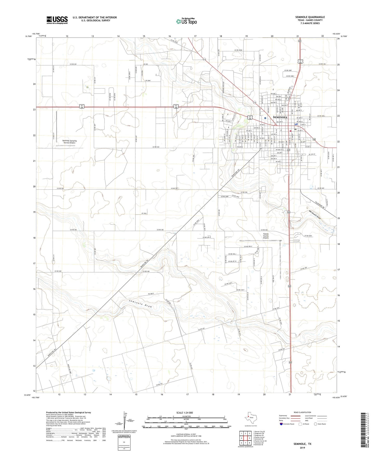
2022 topographic map quadrangle Seminole in the state of Texas. Scale: 1:24000. Based on the newly updated USGS 7.5' US Topo map series, this map is in the following counties: Gaines. The map contains contour data, water features, and other items you are used to seeing on USGS maps, but also has updated roads and other features. This is the next generation of topographic maps. Printed on high-quality waterproof paper with UV fade-resistant inks.
Quads adjacent to this one:
West: Paynes Corner
Northwest: Denver City SE
North: Seagraves SW
Northeast: Seagraves SE
East: Seminole NE
Southeast: Seminole SE
South: Seminole SW
Southwest: Paynes Corner SE
This map covers the same area as the classic USGS quad with code o32102f6.
Contains the following named places: Church of Christ, City of Seminole, First Baptist Church, First Presbyterian Church, Gaines County, Gaines County Airport, Gaines County Cemetery, Gaines County Constable's Office Precinct 1, Gaines County Courthouse, Gaines County Jail, Gaines County Sheriff's Office, KIKZ-AM (Seminole), KSEM-FM (Seminole), Memorial Hospital, Seminole, Seminole City Hall, Seminole Division, Seminole Elementary School, Seminole Emergency Medical Service, Seminole High School, Seminole Junior High School, Seminole Police Department, Seminole Post Office, Seminole Primary School, Seminole Spraying Service Airport, Seminole Success Center, Seminole Volunteer Fire Department, Temple Baptist Church, Trinity Baptist Church, Young Elementary School, Young School, ZIP Code: 79360