MyTopo
Shady Grove Texas US Topo Map
Couldn't load pickup availability
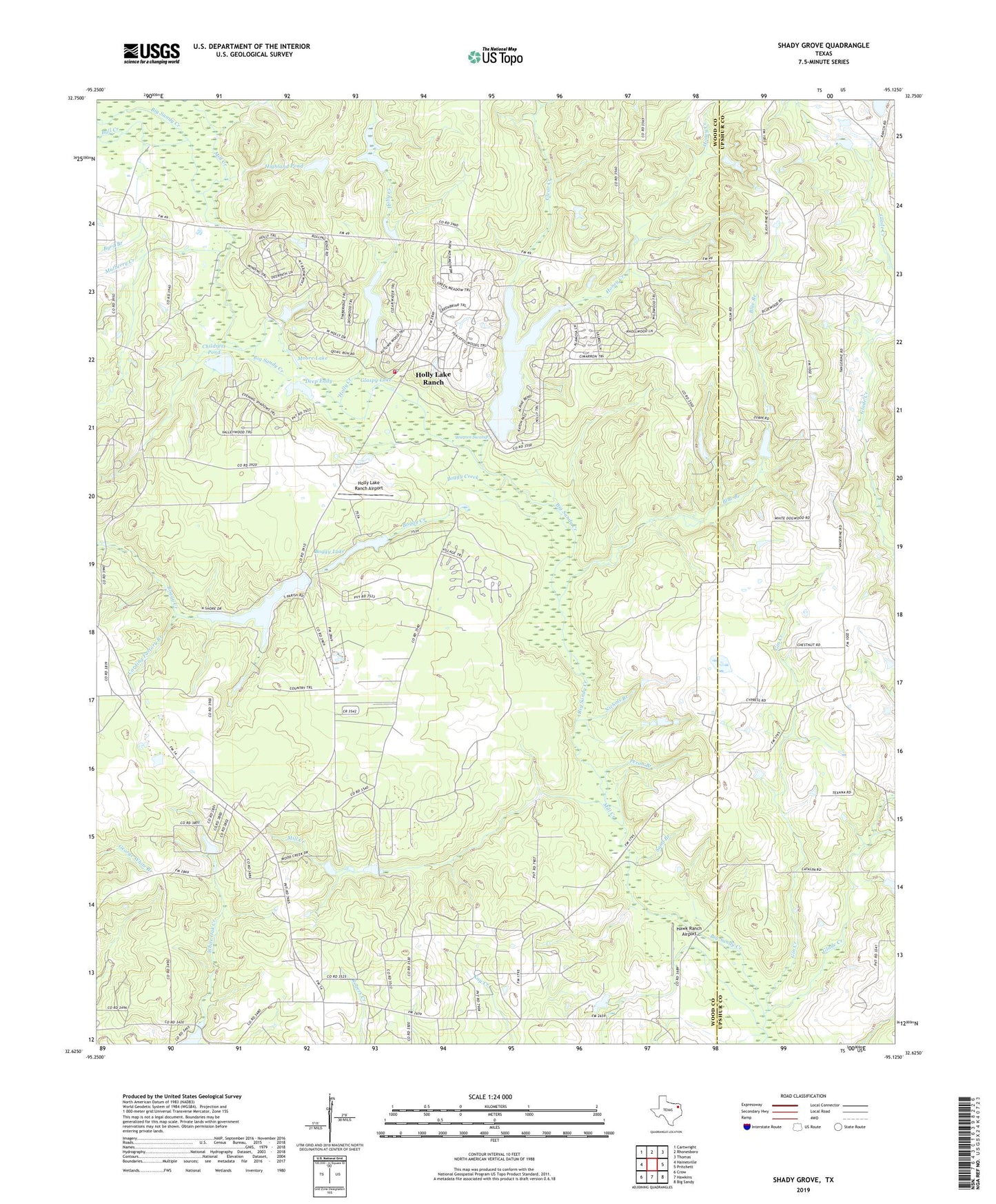
2019 topographic map quadrangle Shady Grove in the state of Texas. Scale: 1:24000. Based on the newly updated USGS 7.5' US Topo map series, this map is in the following counties: Wood, Upshur. The map contains contour data, water features, and other items you are used to seeing on USGS maps, but also has updated roads and other features. This is the next generation of topographic maps. Printed on high-quality waterproof paper with UV fade-resistant inks.
Quads adjacent to this one:
West: Hainesville
Northwest: Cartwright
North: Rhonesboro
Northeast: Thomas
East: Pritchett
Southeast: Big Sandy
South: Hawkins
Southwest: Crow
Contains the following named places: Black Branch, Blue Branch, Boggy Creek, Boggy Lake, Boggy Lake Dam, Brookhaven Lodge, Brooks Lake, Brooks Lake Dam, Bull Creek, Byrd Branch, Carding Factory Branch, Childress Pond, Clear Creek, Clonts Ranch, Deep Eddy, Galena Park Branch Library, Gin Creek, Glade Creek, Glaspy Lake, Greenbriar Creek, Hawk Ranch Airport, Hawkins Division, Highland Pond, Holly Creek, Holly Lake, Holly Lake Dam, Holly Lake Ranch Airport, Holly Lake Ranch Census Designated Place, Holly Lake Volunteer Fire Department, Honey Creek, Jacinto City Branch Library, Kingwood Branch Library, Lake Greenbriar, Little Mound Missionary Church, Maple Springs Church, Mill Creek, Moore Lake, Mulberry Creek, Nichols Branch, North Channel Branch Library, Parker Williams Branch Library, Peron Branch, Peron Church, Pine Mills Oil Field, Sand Branch, Shady Grove, Warren Swamp, ZIP Code: 75765