MyTopo
Thomas Texas US Topo Map
Couldn't load pickup availability
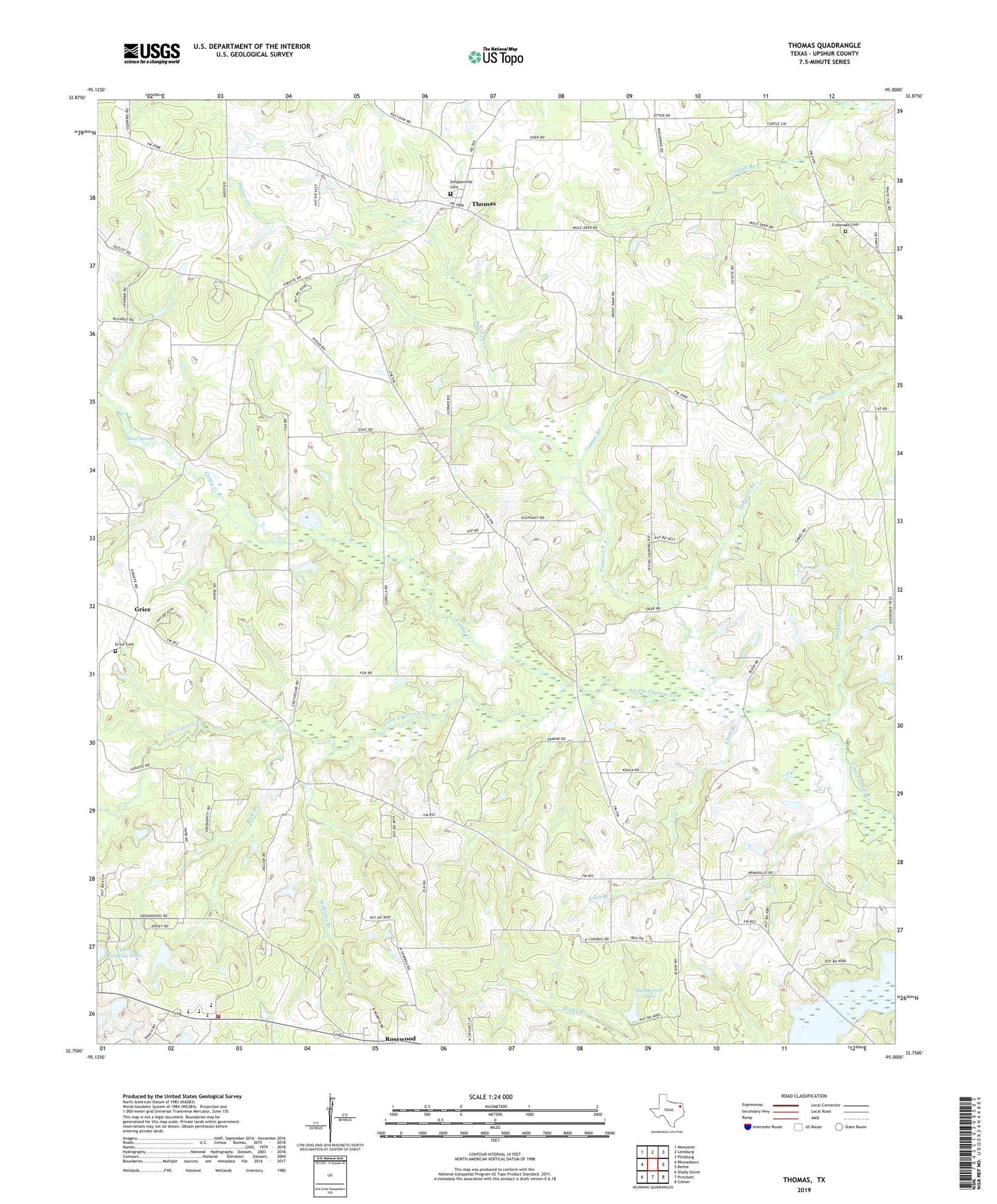
2022 topographic map quadrangle Thomas in the state of Texas. Scale: 1:24000. Based on the newly updated USGS 7.5' US Topo map series, this map is in the following counties: Upshur. The map contains contour data, water features, and other items you are used to seeing on USGS maps, but also has updated roads and other features. This is the next generation of topographic maps. Printed on high-quality waterproof paper with UV fade-resistant inks.
Quads adjacent to this one:
West: Rhonesboro
Northwest: Newsome
North: Leesburg
Northeast: Pittsburg
East: Bettie
Southeast: Gilmer
South: Pritchett
Southwest: Shady Grove
This map covers the same area as the classic USGS quad with code o32095g1.
Contains the following named places: Allen Lake, Allen Lake Dam, Antioch Church, Bear Springs, Beck Branch, Caney Creek, Copper Branch, Crossroad Cemetery, Enon, Enon Branch, Enon Church, Grice, Grice Cemetery, Hamberlin Branch, Harmony Church, Harmony Consolidated Volunteer Fire Department, Harmony School, Henderson Lake, Henderson Lake Dam, Johnson Branch, Prairie Creek, Rosewood, Simpsonville, Simpsonville Cemetery, Soules Chapel, Stratford Branch Library, Thomas, Valley Spring Church, Williams Branch