MyTopo
Shafter Draw Texas US Topo Map
Couldn't load pickup availability
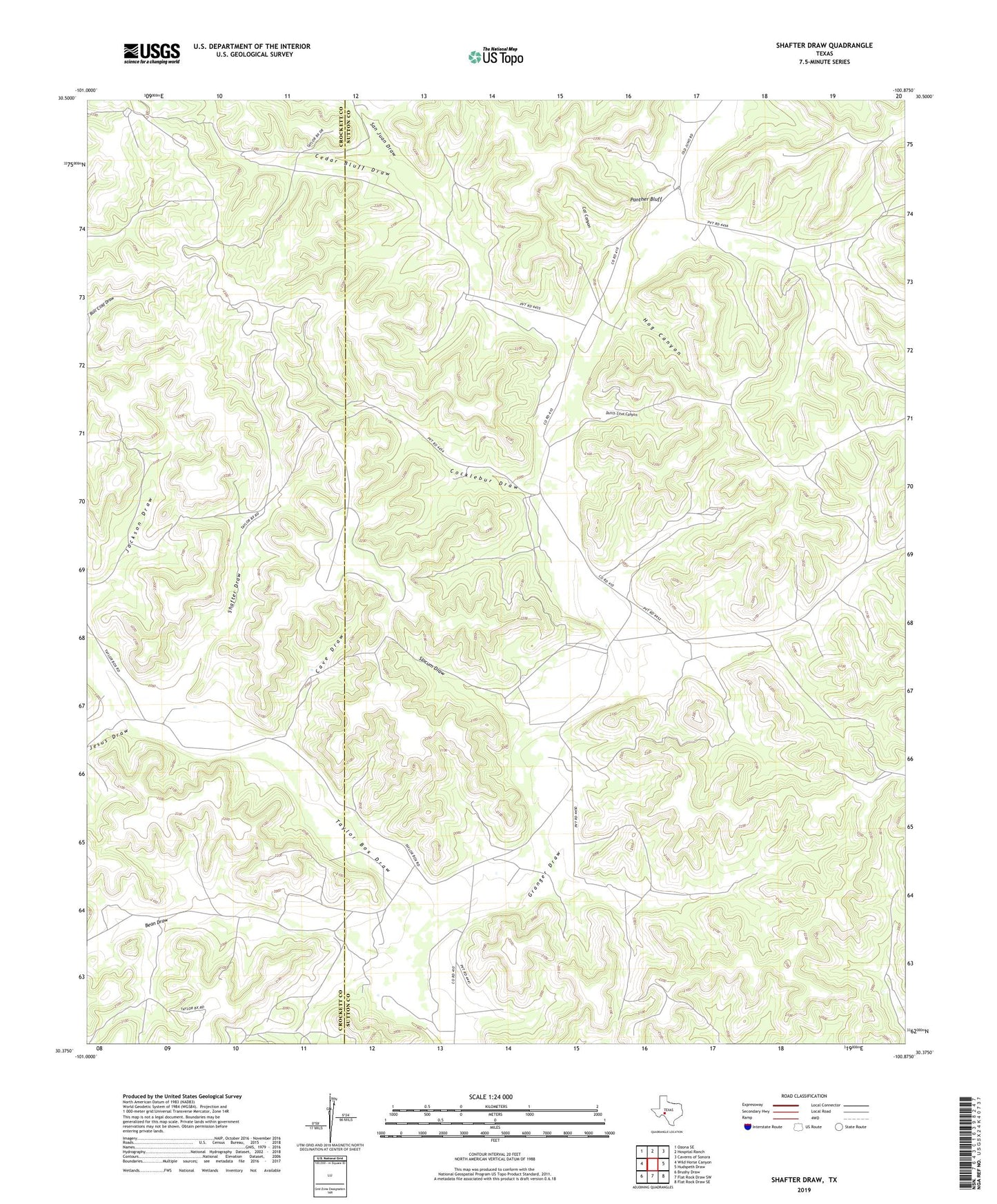
2022 topographic map quadrangle Shafter Draw in the state of Texas. Scale: 1:24000. Based on the newly updated USGS 7.5' US Topo map series, this map is in the following counties: Sutton, Crockett. The map contains contour data, water features, and other items you are used to seeing on USGS maps, but also has updated roads and other features. This is the next generation of topographic maps. Printed on high-quality waterproof paper with UV fade-resistant inks.
Quads adjacent to this one:
West: Wild Horse Canyon
Northwest: Ozona SE
North: Hospital Ranch
Northeast: Caverns of Sonora
East: Hudspeth Draw
Southeast: Flat Rock Draw SE
South: Flat Rock Draw SW
Southwest: Brushy Draw
This map covers the same area as the classic USGS quad with code o30100d8.
Contains the following named places: Bean Draw, Bean Well, Cat Canyon, Cave Draw, Cedar Bluff Draw, Cocklebur Draw, Dutch Cove Canyon, Friend Ranch, Hog Canyon, Indian Well, Jesus Draw, Johnson Ranch, Karnes Ranch, Magruder Ranch, Nicks Ranch, Panther Bluff, San Juan Draw, Shafter Draw, Shafter Well, Slocum Draw, Taylor Box Draw