MyTopo
Sheeks Texas US Topo Map
Couldn't load pickup availability
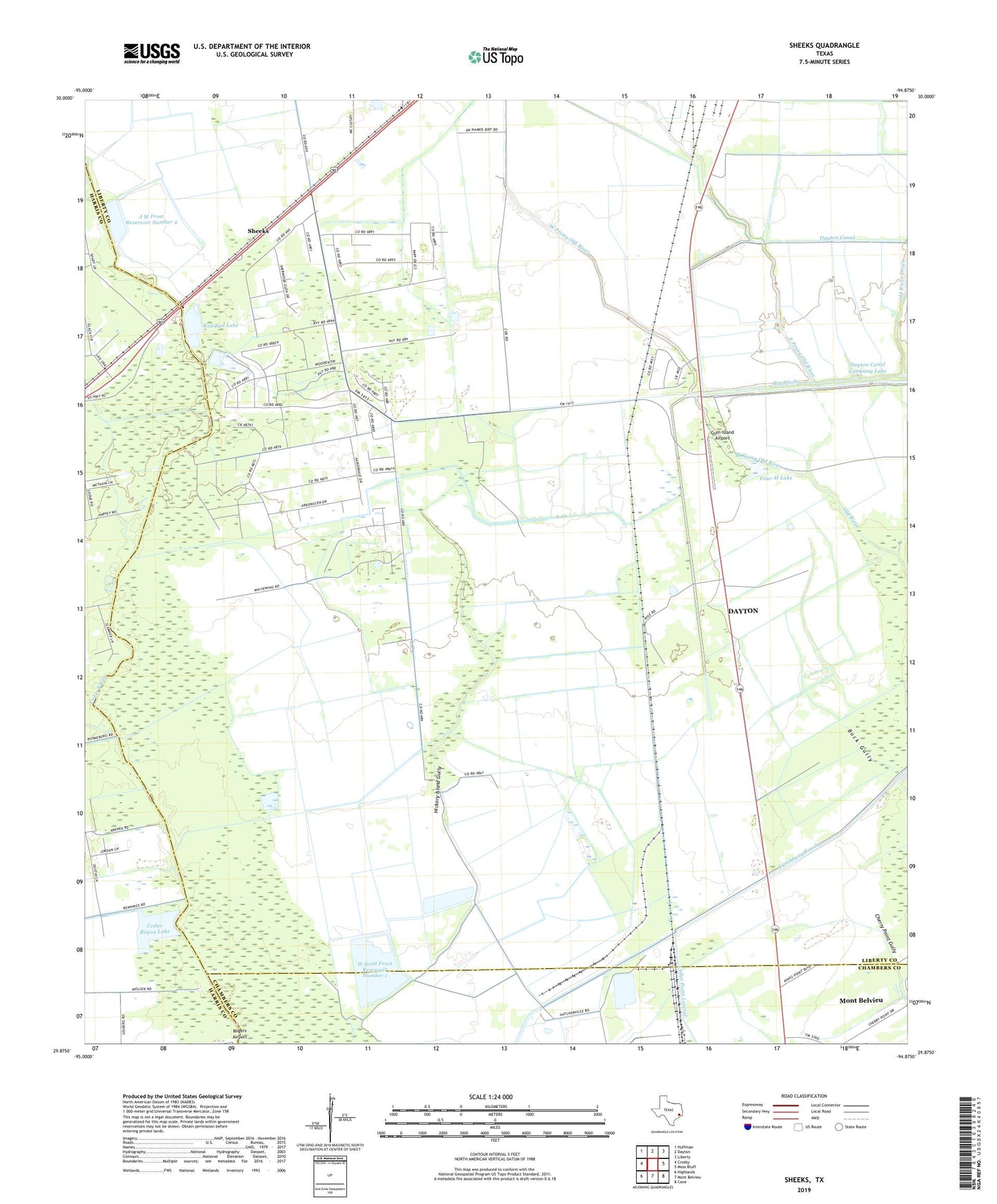
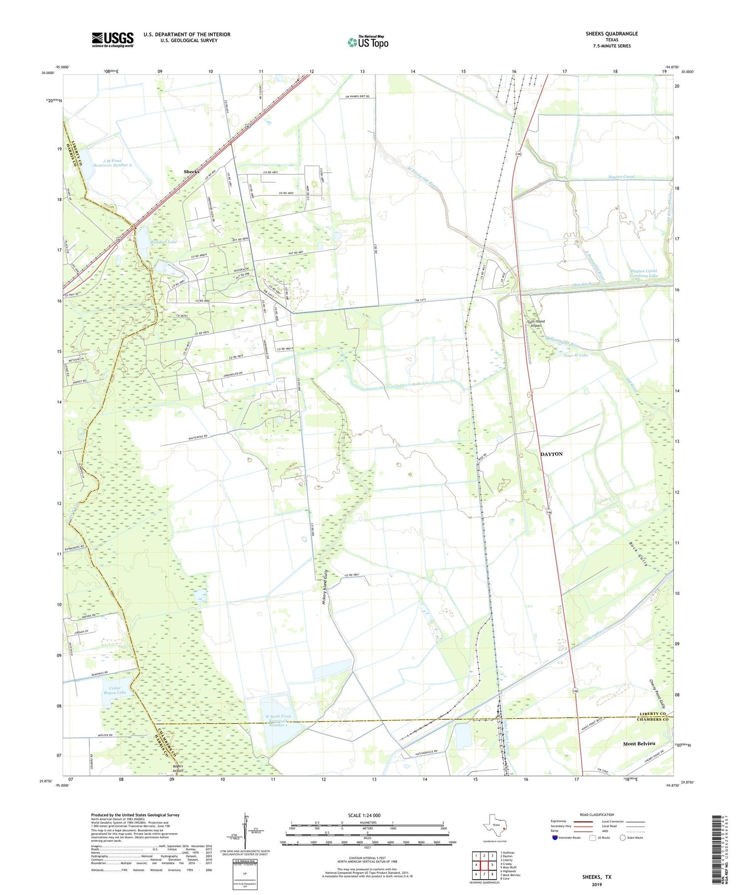
2019 topographic map quadrangle Sheeks in the state of Texas. Scale: 1:24000. Based on the newly updated USGS 7.5' US Topo map series, this map is in the following counties: Liberty, Harris, Chambers. The map contains contour data, water features, and other items you are used to seeing on USGS maps, but also has updated roads and other features. This is the next generation of topographic maps. Printed on high-quality waterproof paper with UV fade-resistant inks.
Quads adjacent to this one:
West: Crosby
Northwest: Huffman
North: Dayton
Northeast: Liberty
East: Moss Bluff
Southeast: Cove
South: Mont Belvieu
Southwest: Highlands
Contains the following named places: Barbers Hill High School Baseball Field, Barbers Hill High School Stadium, Big Ditch, Cedar Bayou Lake, Cedar Bayou Lake Dam, Dayton Canal, Dayton Canal Company Dam, Dayton Canal Company Lake, East Prong Old River, Esperson, Esperson Dome Oil Field, Four-H Lake, Gum Bayou Oil Field, Gum Island Airport, J M Frost III Reservoir Number 3, J M Frost III Reservoir Number 3 Levee, J M Frost Reservoir Number 2, J M Frost Reservoir Number 2 Levee, KTRH-AM (Houston), Old River Drain, Red Bud Lake, Red Bud Lake Dam, Sheeks, W Scott Frost Reservoir Number 1, W Scott Frost Reservoir Number 1 Levee, West Prong Old River