MyTopo
Shep Texas US Topo Map
Couldn't load pickup availability
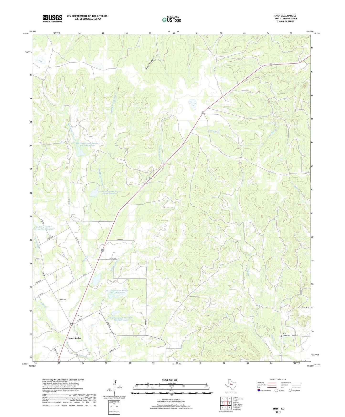
2019 topographic map quadrangle Shep in the state of Texas. Scale: 1:24000. Based on the newly updated USGS 7.5' US Topo map series, this map is in the following counties: Taylor. The map contains contour data, water features, and other items you are used to seeing on USGS maps, but also has updated roads and other features. This is the next generation of topographic maps. Printed on high-quality waterproof paper with UV fade-resistant inks.
Quads adjacent to this one:
West: Hylton
Northwest: Nolan
North: Mountain Pass
Northeast: View
East: Lake Abilene
Southeast: Bradshaw
South: Wingate
Southwest: Church Peak
Contains the following named places: Bluff Creek Cemetery, Cottonwood Creek, East Fork Spring Creek, Flat Top Mountain, Happy Valley, Middle Fork Spring Creek, Sears Airport, Shep, Shep Cemetery, Soil Conservation Service Site 10 Dam, Soil Conservation Service Site 10 Reservoir, Soil Conservation Service Site 11 Dam, Soil Conservation Service Site 11 Reservoir, Soil Conservation Service Site 13a Dam, Soil Conservation Service Site 13a Reservoir, Soil Conservation Service Site 14 Dam, Soil Conservation Service Site 14 Reservoir, Soil Conservation Service Site 15 Dam, Soil Conservation Service Site 15 Reservoir, Spring Creek, West Fork Spring Creek