MyTopo
Sixteen Mountains Texas US Topo Map
Couldn't load pickup availability
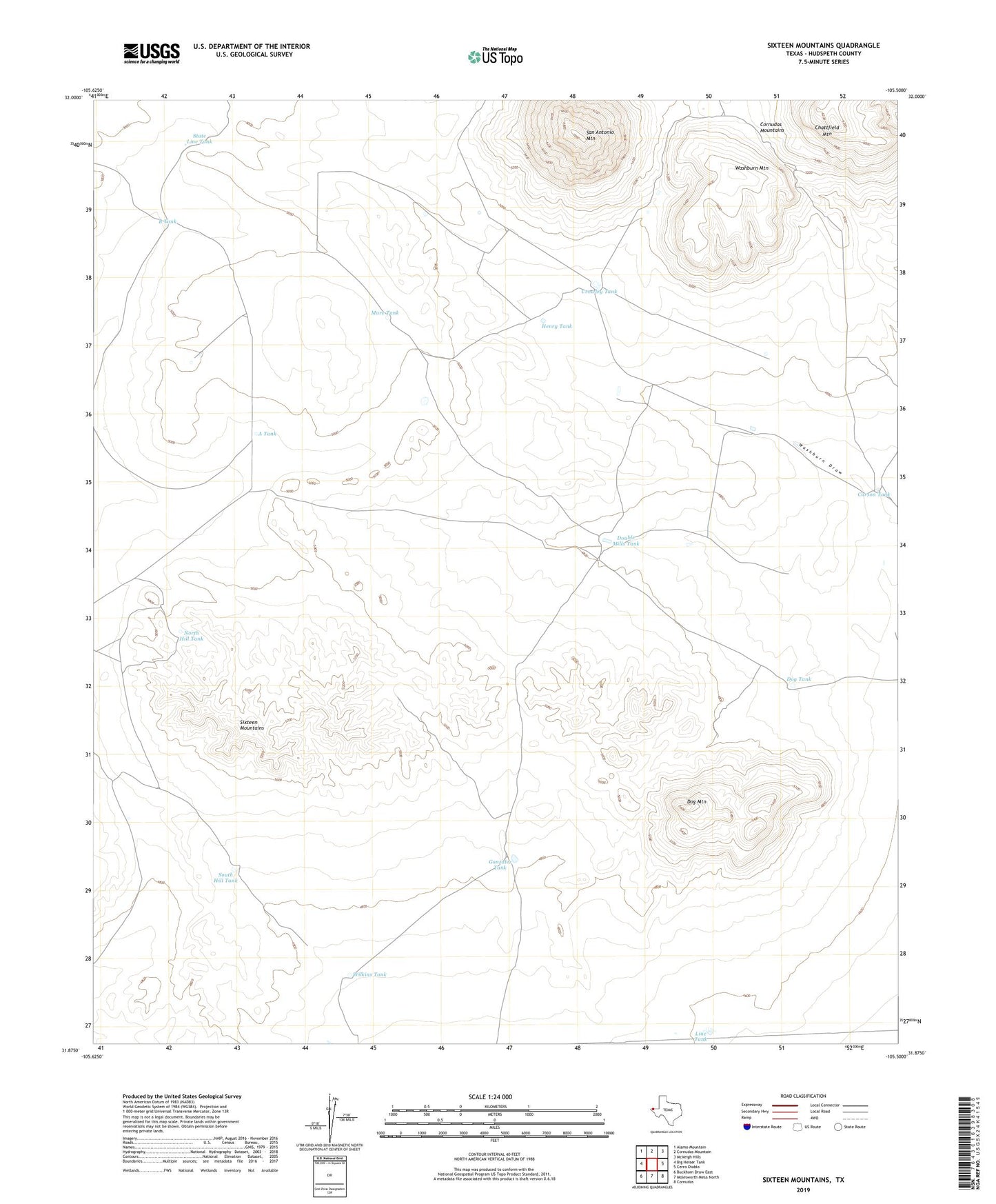
2019 topographic map quadrangle Sixteen Mountains in the state of Texas. Scale: 1:24000. Based on the newly updated USGS 7.5' US Topo map series, this map is in the following counties: Hudspeth. The map contains contour data, water features, and other items you are used to seeing on USGS maps, but also has updated roads and other features. This is the next generation of topographic maps. Printed on high-quality waterproof paper with UV fade-resistant inks.
Quads adjacent to this one:
West: Big Heiser Tank
Northwest: Alamo Mountain
North: Cornudas Mountain
Northeast: McVeigh Hills
East: Cerro Diablo
Southeast: Cornudas
South: Molesworth Mesa North
Southwest: Buckhorn Draw East
Contains the following named places: A Tank, B Tank, Carson Tank, Crowley Tank, Dog Mountain, Dog Tank, Double Mills Tank, Gonzalez Tank, Henry Tank, Line Tank, Mare Tank, North Hill Tank, San Antonio Mountain, Sixteen Mountains, South Hill Tank, State Line Tank, Washburn Mountain, Wilkins Tank