MyTopo
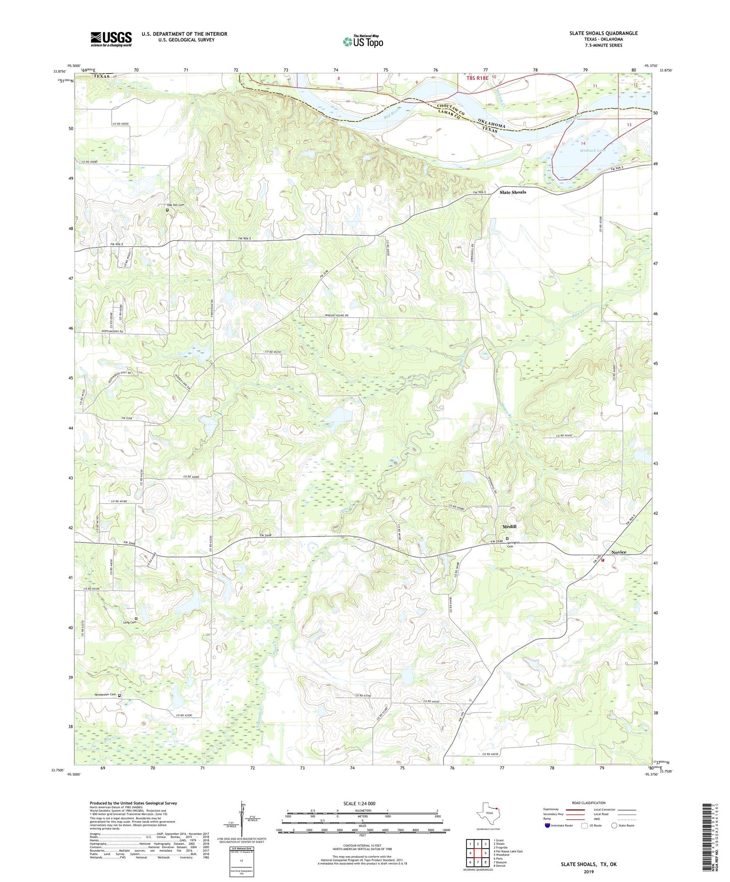
Slate Shoals Texas US Topo Map
Couldn't load pickup availability
2019 topographic map quadrangle Slate Shoals in the states of Texas, Oklahoma. Scale: 1:24000. Based on the newly updated USGS 7.5' US Topo map series, this map is in the following counties: Lamar, Choctaw. The map contains contour data, water features, and other items you are used to seeing on USGS maps, but also has updated roads and other features. This is the next generation of topographic maps. Printed on high-quality waterproof paper with UV fade-resistant inks.
Quads adjacent to this one:
West: Pat Mayse Lake East
Northwest: Grant
North: Shoals
Northeast: Frogville
East: Woodland
Southeast: Detroit
South: Blossom
Southwest: Paris
Contains the following named places: Bounds Church, Bradley Church, Carney Creek, Howard Lake, Howard Lake Dam, KBUS-FM (Paris), KOYN-FM (Paris), Lone Star, Lone Star School, Long Cemetery, Medill, Moran Branch, Newbether Cemetery, Ninemile Creek, Novice, Novice Volunteer Fire Department, Oak Hill Cemetery, Oak Hill Church, Palestine Church, Pee Dee School, Red Hill Church, Reeds Chapel, Riverside Church, Slate Shoals, Soil Conservation Service Site 14 Dam, Soil Conservation Service Site 14 Reservoir, Soil Conservation Service Site 15 Dam, Soil Conservation Service Site 15 Reservoir, Soil Conservation Service Site 16 Dam, Soil Conservation Service Site 16 Reservoir, Soil Conservation Service Site 17 Dam, Soil Conservation Service Site 17 Reservoir, Soil Conservation Service Site 18 Dam, Soil Conservation Service Site 18 Reservoir, Springhill Cemetery, Stallings Lake, Stallings Lake Dam, Womack Lake, Womack Plantation Airport, Youngs Chapel, ZIP Code: 75473