MyTopo
Frogville Oklahoma US Topo Map
Couldn't load pickup availability
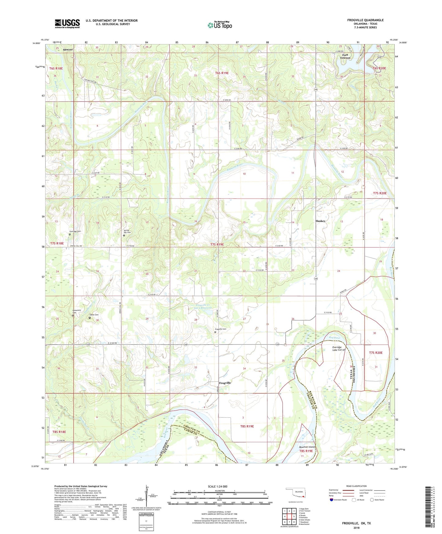
2022 topographic map quadrangle Frogville in the states of Oklahoma, Texas. Scale: 1:24000. Based on the newly updated USGS 7.5' US Topo map series, this map is in the following counties: Choctaw, Red River, Lamar. The map contains contour data, water features, and other items you are used to seeing on USGS maps, but also has updated roads and other features. This is the next generation of topographic maps. Printed on high-quality waterproof paper with UV fade-resistant inks.
Quads adjacent to this one:
West: Shoals
Northwest: Hugo Dam
North: Fort Towson
Northeast: Swink
East: Kiomatia
Southeast: Manchester
South: Woodland
Southwest: Slate Shoals
Contains the following named places: Bird Creek, Bowman Island, Cedar Creek, Eastern Star School, Everidge Cemetery, Everidge Lake Cut-off, Frogville, Frogville Cemetery, Frogville Creek Site 1 Dam, Frogville Creek Site 1 Reservoir, Frogville Creek Site 2 Dam, Frogville Creek Site 2 Reservoir, Garvin School, Goodwater Creek, Huskey, Lake Raymond Gary, Lake Raymond Gary Dam, Lake View School, Missionary Cemetery, North Sandy Branch, Oakes Cemetery, Oma School, Plainview School, Raymond Gary State Park, Rock Creek, Rosemound School, Saint Johns Church, Sandy Branch, South Sandy Branch, Spring Hill Cemetery