MyTopo
Smiley Texas US Topo Map
Couldn't load pickup availability
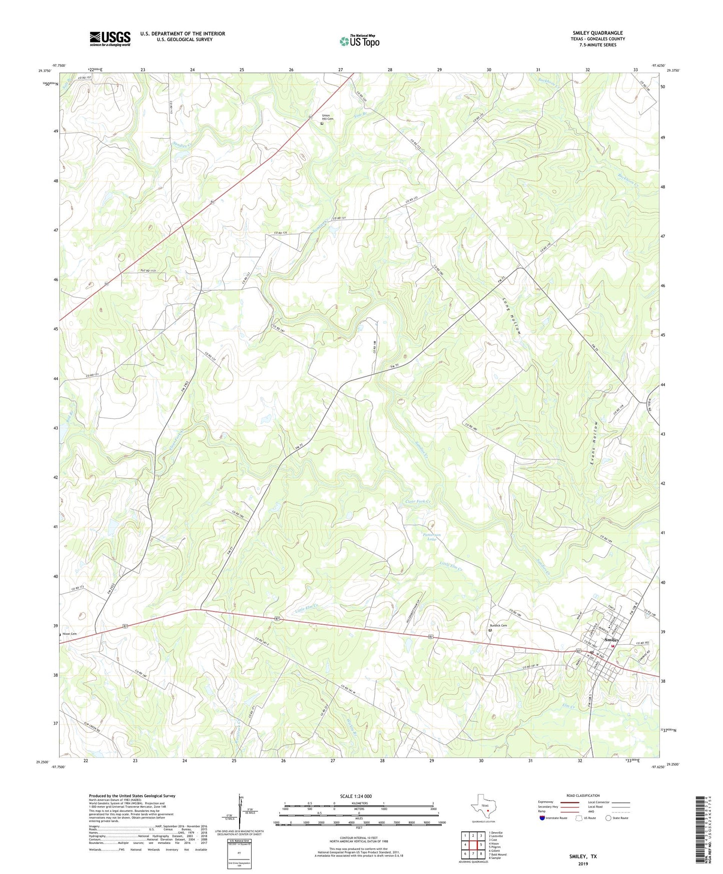
2019 topographic map quadrangle Smiley in the state of Texas. Scale: 1:24000. Based on the newly updated USGS 7.5' US Topo map series, this map is in the following counties: Gonzales. The map contains contour data, water features, and other items you are used to seeing on USGS maps, but also has updated roads and other features. This is the next generation of topographic maps. Printed on high-quality waterproof paper with UV fade-resistant inks.
Quads adjacent to this one:
West: Nixon
Northwest: Dewville
North: Leesville
Northeast: Cost
East: Pilgrim
Southeast: Sample
South: Bald Mound
Southwest: Gillett
Contains the following named places: Bundick Cemetery, City of Smiley, Clear Fork Creek, Evans Hollow, Little Elm Creek, Long Hollow, Nixon Cemetery, O'Neal Creek, Patterson Lake, Red Branch, Schoolland, Smiley, Smiley Post Office, Smiley Volunteer Fire Department, Union Hill Cemetery, Yow Branch