MyTopo
Nixon Texas US Topo Map
Couldn't load pickup availability
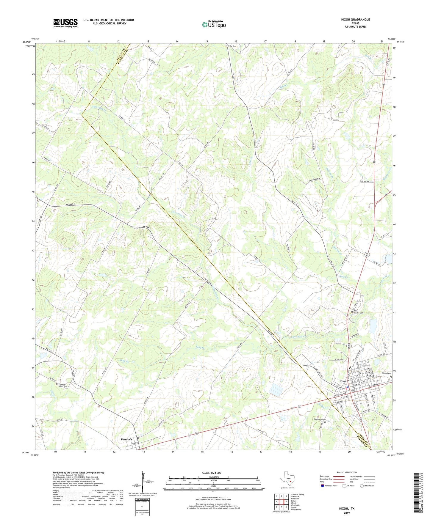
2022 topographic map quadrangle Nixon in the state of Texas. Scale: 1:24000. Based on the newly updated USGS 7.5' US Topo map series, this map is in the following counties: Gonzales, Wilson. The map contains contour data, water features, and other items you are used to seeing on USGS maps, but also has updated roads and other features. This is the next generation of topographic maps. Printed on high-quality waterproof paper with UV fade-resistant inks.
Quads adjacent to this one:
West: Alum
Northwest: Thomas Springs
North: Dewville
Northeast: Leesville
East: Smiley
Southeast: Bald Mound
South: Gillett
Southwest: Stockdale
This map covers the same area as the classic USGS quad with code o29097c7.
Contains the following named places: Camp Valley Church, City of Nixon, Demmer Cemetery, Dewville Cemetery, First Assembly of God Church, First Temple Assembly of God Church, Floresville Alternative Education Center, Gonzales County Emergency Medical Services / Rescue Station 2, Macedonia Baptist Church, Murray Branch, Nixon, Nixon - Smiley Elementary School, Nixon - Smiley High School, Nixon City Hall, Nixon Fire Department, Nixon Post Office, Nose Creek, Pandora, Pandora Post Office, Pleasant Valley Cemetery, Tally Branch, Union, Union Post Office, Union Valley Church, White Rancho Cemetery, ZIP Codes: 78140, 78143