MyTopo
Southwest Palestine Texas US Topo Map
Couldn't load pickup availability
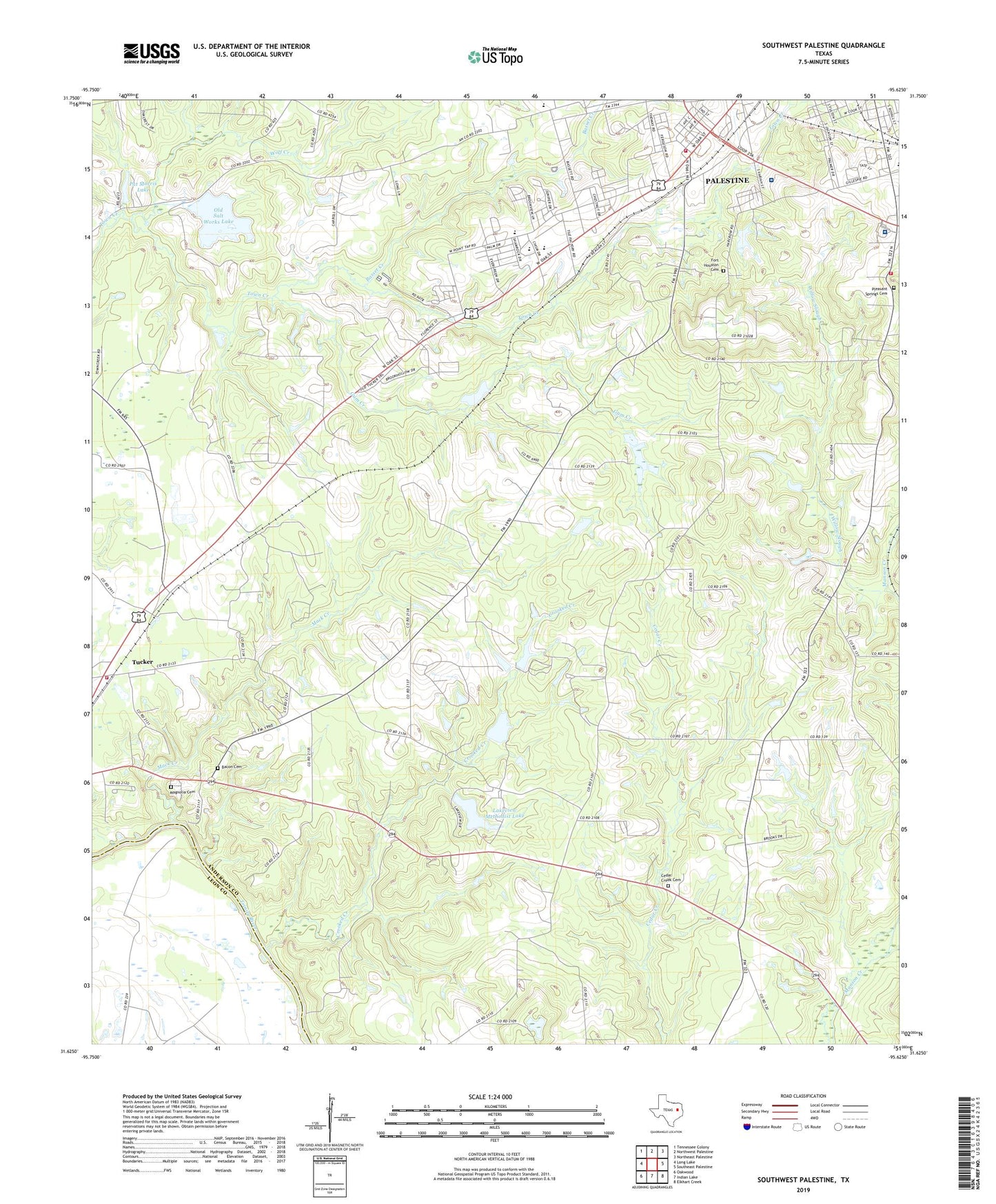
2019 topographic map quadrangle Southwest Palestine in the state of Texas. Scale: 1:24000. Based on the newly updated USGS 7.5' US Topo map series, this map is in the following counties: Anderson, Leon. The map contains contour data, water features, and other items you are used to seeing on USGS maps, but also has updated roads and other features. This is the next generation of topographic maps. Printed on high-quality waterproof paper with UV fade-resistant inks.
Quads adjacent to this one:
West: Long Lake
Northwest: Tennessee Colony
North: Northwest Palestine
Northeast: Northeast Palestine
East: Southeast Palestine
Southeast: Elkhart Creek
South: Indian Lake
Southwest: Oakwood
Contains the following named places: Bacon Cemetery, Basset Creek, Bassett Road Baptist Church, Cedar Creek Cemetery, Cedar Creek Church, Chalybeate Creek, Church of Christ, Crooked Creek, Duggeys Lake Dam, Ebenezer Church, Fort Houston Cemetery, Four Pines School, Gooch Lake, Gooch Lake Dam, Gum Creek, Lakeview Assembly, Lakeview Methodist Lake, Lakeview Methodist Lake Dam, Lighthouse Pentecostal Church, Living Green Church, Long Lake Oil Field, Mack Creek, Magnolia Cemetery, Mount Moriah Church, New Salem Church, Old Salt Works Lake, Palestine / Southside Volunteer Fire Department, Palestine Fire Department Station 2, Palestine Regional Medical Center, Pat Morris Dam, Pat Morris Lake, Pilgrim Hill Church, Pleasant Springs Cemetery, Sheridan Terrace Baptist Church, Southside Primary School, Sulphur Springs Church, Tucker, Tucker Volunteer Fire Department, Westwood Elementary School, Westwood High School, Westwood Junior High School, Westwood Primary School, Westwood United Methodist Church, William and Caroline Broyles House, Willow Slough, Wilson Lake, Wilson Lake Dam, Wolf Creek